Area Overview for UB10 9AE
Photos of UB10 9AE
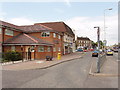
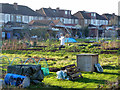
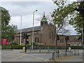
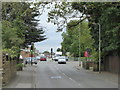
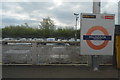
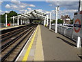
28 photos from this area
Area Information
Key information about the UB10 9AE including its size, population, and administrative classification.
- Area Type
- Postcode
- Area Size
- 2.2 hectares
- Population
- 1538
- Population Density
- 4501 people/km²
House Prices in UB10 9AE
46
Properties
£311,079
Average Sold Price
£108,000
Lowest Price
£595,000
Highest Price
Showing 46 properties
| Address | Type | Beds | Baths | Last Sale Price | Last Sale Date | |
|---|---|---|---|---|---|---|
| 26 Granville Road, Uxbridge, UB10 9AE | Terraced | 4 | 2 | £595,000 | Jun 2025 | |
| 43 Granville Road, Uxbridge, UB10 9AE | Terraced | 3 | 1 | £481,000 | Dec 2023 | |
| 47 Granville Road, Uxbridge, UB10 9AE | Terraced | 3 | 1 | £490,000 | Sep 2023 | |
| 55 Granville Road, Uxbridge, UB10 9AE | Terraced | 3 | 1 | £519,950 | Jun 2022 | |
| 57 Granville Road, Uxbridge, UB10 9AE | house | 3 | 1 | £455,000 | Aug 2021 | |
| 61 Granville Road, Uxbridge, UB10 9AE | house | - | - | £423,000 | Aug 2020 | |
| 67 Granville Road, Uxbridge, UB10 9AE | Semi-detached | 4 | 2 | £440,000 | Dec 2018 | |
| 20 Granville Road, Uxbridge, UB10 9AE | Terraced | 4 | 2 | £477,500 | Aug 2018 | |
| 45 Granville Road, Uxbridge, UB10 9AE | house | 3 | - | £250,000 | Jul 2018 | |
| 39 Granville Road, Uxbridge, UB10 9AE | Terraced | 4 | 2 | £500,000 | Aug 2017 |
Page 1 of 5
Energy Efficiency in UB10 9AE
Amenities
Schools
| Rank | School | Type | Entry gender | Ages |
|---|
Explore more schools in this area
Go to Schools tabDemographics
Household Size
Family (3-5 people)
most common
Accommodation Type
Houses
most common
Tenure
76
majority
Ethnic Group
White
most common
Religion
N/A
most common
Household Composition
N/A
most common
Age
47
median
Adults (30-64 years)
most common
Household Deprivation
N/A
with no deprivation
NS-SEC
35
in Lower managerial occupations
Explore more demographic insights in this area
Go to Demographics tabPlanning
Planning Constraints
- Flood RiskPremium
- Ramsar Wetland SitesPremium
- Area of Outstanding Natural BeautyPremium
- Protected Nature ReservePremium
- Protected WoodlandPremium