Area Overview for UB10 8UH
Photos of UB10 8UH
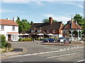
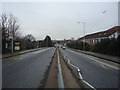
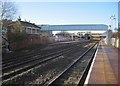
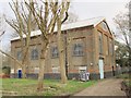

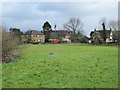
100 photos from this area
Area Information
Key information about the UB10 8UH including its size, population, and administrative classification.
- Area Type
- Postcode
- Area Size
- 8216 m²
- Population
- 1330
- Population Density
- 3393 people/km²
House Prices in UB10 8UH
36
Properties
£148,200
Average Sold Price
£31,750
Lowest Price
£285,000
Highest Price
Showing 36 properties
| Address | Type | Beds | Baths | Last Sale Price | Last Sale Date | |
|---|---|---|---|---|---|---|
| 229 Aylsham Drive, Ickenham, UB10 8UH | Flat | - | - | £285,000 | Sep 2023 | |
| 249 Aylsham Drive, Ickenham, UB10 8UH | Flat | - | 1 | £167,500 | Oct 2022 | |
| 237 Aylsham Drive, Ickenham, UB10 8UH | Flat | - | 1 | £155,000 | Aug 2022 | |
| 219 Aylsham Drive, Ickenham, UB10 8UH | Flat | 2 | - | £270,000 | Mar 2022 | |
| 257 Aylsham Drive, Ickenham, UB10 8UH | Flat | - | - | £158,000 | Jun 2018 | |
| 233 Aylsham Drive, Ickenham, UB10 8UH | Flat | - | - | £242,000 | Feb 2018 | |
| 247 Aylsham Drive, Ickenham, UB10 8UH | Flat | - | - | £160,000 | Jan 2018 | |
| 199 Aylsham Drive, Ickenham, UB10 8UH | Flat | 1 | 1 | £250,000 | Mar 2016 | |
| 205 Aylsham Drive, Ickenham, UB10 8UH | Flat | 1 | 1 | £225,000 | Jun 2015 | |
| 221 Aylsham Drive, Ickenham, UB10 8UH | Flat | 1 | - | £197,500 | Mar 2015 |
Page 1 of 4
Energy Efficiency in UB10 8UH
Amenities
Schools
| Rank | School | Type | Entry gender | Ages |
|---|
Explore more schools in this area
Go to Schools tabDemographics
Household Size
One person
most common
Accommodation Type
Houses
most common
Tenure
53
majority
Ethnic Group
White
most common
Religion
N/A
most common
Household Composition
N/A
most common
Age
47
median
Adults (30-64 years)
most common
Household Deprivation
N/A
with no deprivation
NS-SEC
47
in Lower managerial occupations
Explore more demographic insights in this area
Go to Demographics tabPlanning
Planning Constraints
- Flood RiskPremium
- Ramsar Wetland SitesPremium
- Area of Outstanding Natural BeautyPremium
- Protected Nature ReservePremium
- Protected WoodlandPremium