Area Overview for UB10 8LT
Photos of UB10 8LT
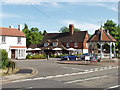
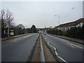
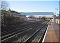
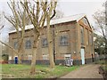

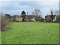
100 photos from this area
Area Information
Key information about the UB10 8LT including its size, population, and administrative classification.
- Area Type
- Postcode
- Area Size
- 1.8 hectares
- Population
- 2483
- Population Density
- 5495 people/km²
House Prices in UB10 8LT
42
Properties
£285,608
Average Sold Price
£16,750
Lowest Price
£850,000
Highest Price
Showing 42 properties
| Address | Type | Beds | Baths | Last Sale Price | Last Sale Date | |
|---|---|---|---|---|---|---|
| 141 The Greenway, Ickenham, UB10 8LT | Bungalow | 5 | 3 | £830,000 | Jun 2025 | |
| 175 The Greenway, Ickenham, UB10 8LT | Flat | 2 | 1 | £280,000 | Sep 2023 | |
| 22 The Greenway, Ickenham, UB10 8LT | Semi-detached | 4 | 3 | £850,000 | Dec 2020 | |
| 191 The Greenway, Ickenham, UB10 8LT | Maisonette | - | - | £315,000 | Oct 2020 | |
| 177 The Greenway, Ickenham, UB10 8LT | Maisonette | - | - | £290,000 | Jul 2020 | |
| 179 The Greenway, Ickenham, UB10 8LT | Maisonette | 2 | 1 | £330,000 | Mar 2020 | |
| 14 The Greenway, Ickenham, UB10 8LT | house | 4 | 3 | £16,750 | Jul 2019 | |
| 149A The Greenway, Ickenham, UB10 8LT | Semi-detached | 4 | 3 | £565,000 | Aug 2016 | |
| 139 The Greenway, Ickenham, UB10 8LT | Detached | 5 | 3 | £700,000 | Oct 2015 | |
| 193 The Greenway, Ickenham, UB10 8LT | Maisonette | 2 | 1 | £269,950 | Nov 2014 |
Page 1 of 5
Energy Efficiency in UB10 8LT
Amenities
Schools
| Rank | School | Type | Entry gender | Ages |
|---|
Explore more schools in this area
Go to Schools tabDemographics
Household Size
Family (3-5 people)
most common
Accommodation Type
Houses
most common
Tenure
65
majority
Ethnic Group
White
most common
Religion
N/A
most common
Household Composition
N/A
most common
Age
47
median
Adults (30-64 years)
most common
Household Deprivation
N/A
with no deprivation
NS-SEC
51
in Lower managerial occupations
Explore more demographic insights in this area
Go to Demographics tabPlanning
Planning Constraints
- Flood RiskPremium
- Ramsar Wetland SitesPremium
- Area of Outstanding Natural BeautyPremium
- Protected Nature ReservePremium
- Protected WoodlandPremium