Area Overview for UB10 0JB
Photos of UB10 0JB
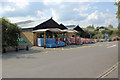
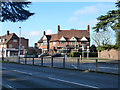
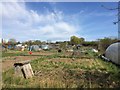
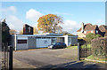
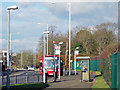
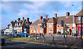
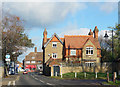
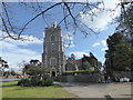
47 photos from this area
Area Information
Key information about the UB10 0JB including its size, population, and administrative classification.
- Area Type
- Postcode
- Area Size
- 2.0 hectares
- Population
- 2696
- Population Density
- 2936 people/km²
House Prices in UB10 0JB
29
Properties
£355,713
Average Sold Price
£130,000
Lowest Price
£595,000
Highest Price
Showing 29 properties
| Address | Type | Beds | Baths | Last Sale Price | Last Sale Date | |
|---|---|---|---|---|---|---|
| 8 Hillingdon Hill, Uxbridge, UB10 0JB | Semi-detached | 6 | 3 | £550,000 | Apr 2021 | |
| 42 Hillingdon Hill, Uxbridge, UB10 0JB | Detached | 3 | - | £595,000 | Mar 2020 | |
| 32 Hillingdon Hill, Uxbridge, UB10 0JB | house | 3 | - | £405,000 | Jul 2019 | |
| 10 Hillingdon Hill, Uxbridge, UB10 0JB | house | 3 | - | £445,000 | Nov 2018 | |
| 38 Hillingdon Hill, Uxbridge, UB10 0JB | Terraced | 3 | 1 | £432,500 | Oct 2017 | |
| 2A Hillingdon Hill, Uxbridge, UB10 0JB | Terraced | 3 | 1 | £485,000 | Feb 2017 | |
| 26 Hillingdon Hill, Uxbridge, UB10 0JB | Semi-detached | 3 | - | £400,000 | Feb 2016 | |
| 40 Hillingdon Hill, Uxbridge, UB10 0JB | Semi-detached | 3 | 1 | £399,950 | Nov 2014 | |
| 34 Hillingdon Hill, Uxbridge, UB10 0JB | Semi-detached | 1 | 2 | £276,500 | Jun 2013 | |
| 24 Hillingdon Hill, Uxbridge, UB10 0JB | Semi-detached | 3 | 1 | £290,000 | May 2011 |
Page 1 of 3
Energy Efficiency in UB10 0JB
Amenities
Schools
| Rank | School | Type | Entry gender | Ages |
|---|
Explore more schools in this area
Go to Schools tabDemographics
Household Size
One person
most common
Accommodation Type
Houses
most common
Tenure
51
majority
Ethnic Group
White
most common
Religion
N/A
most common
Household Composition
N/A
most common
Age
22
median
Young Adults (15-29 years)
most common
Household Deprivation
N/A
with no deprivation
NS-SEC
15
in Lower managerial occupations
Explore more demographic insights in this area
Go to Demographics tabPlanning
Planning Constraints
- Flood RiskPremium
- Ramsar Wetland SitesPremium
- Area of Outstanding Natural BeautyPremium
- Protected Nature ReservePremium
- Protected WoodlandPremium