Area Overview for UB10 0FN
Photos of UB10 0FN

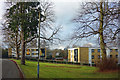
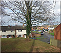
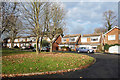
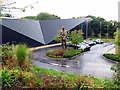
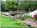
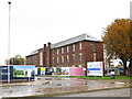

74 photos from this area
Area Information
Key information about the UB10 0FN including its size, population, and administrative classification.
- Area Type
- Postcode
- Area Size
- 1.4 hectares
- Population
- 1637
- Population Density
- 6186 people/km²
House Prices in UB10 0FN
57
Properties
£518,770
Average Sold Price
£431,250
Lowest Price
£650,000
Highest Price
Showing 57 properties
| Address | Type | Beds | Baths | Last Sale Price | Last Sale Date | |
|---|---|---|---|---|---|---|
| 63 Churchill Road, Uxbridge, UB10 0FN | house | - | - | £431,250 | Feb 2025 | |
| 21 Churchill Road, Uxbridge, UB10 0FN | Terraced | 5 | 4 | £620,000 | Nov 2021 | |
| 29 Churchill Road, Uxbridge, UB10 0FN | Detached | 4 | 3 | £635,000 | Jun 2021 | |
| 37 Churchill Road, Uxbridge, UB10 0FN | Semi-detached | 4 | 3 | £570,000 | Dec 2019 | |
| 75 Churchill Road, Uxbridge, UB10 0FN | house | - | - | £540,000 | Jun 2019 | |
| 79 Churchill Road, Uxbridge, UB10 0FN | Terraced | 3 | 2 | £545,000 | Apr 2019 | |
| 81 Churchill Road, Uxbridge, UB10 0FN | Semi-detached | 3 | 1 | £540,000 | Apr 2019 | |
| 73 Churchill Road, Uxbridge, UB10 0FN | house | - | - | £580,000 | Apr 2019 | |
| 83 Churchill Road, Uxbridge, UB10 0FN | house | - | - | £580,000 | Apr 2019 | |
| 69 Churchill Road, Uxbridge, UB10 0FN | Terraced | 3 | 2 | £540,000 | Mar 2019 |
Page 1 of 6
Energy Efficiency in UB10 0FN
Amenities
Schools
| Rank | School | Type | Entry gender | Ages |
|---|
Explore more schools in this area
Go to Schools tabDemographics
Household Size
Family (3-5 people)
most common
Accommodation Type
Houses
most common
Tenure
52
majority
Ethnic Group
White
most common
Religion
N/A
most common
Household Composition
N/A
most common
Age
47
median
Adults (30-64 years)
most common
Household Deprivation
N/A
with no deprivation
NS-SEC
39
in Lower managerial occupations
Explore more demographic insights in this area
Go to Demographics tabPlanning
Planning Constraints
- Flood RiskPremium
- Ramsar Wetland SitesPremium
- Area of Outstanding Natural BeautyPremium
- Protected Nature ReservePremium
- Protected WoodlandPremium