Area Overview for UB10 0AD
Photos of UB10 0AD
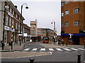
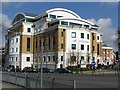
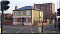
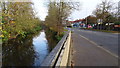
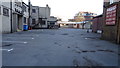
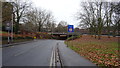
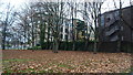
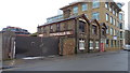
82 photos from this area
Area Information
Key information about the UB10 0AD including its size, population, and administrative classification.
- Area Type
- Postcode
- Area Size
- 3.5 hectares
- Population
- 1637
- Population Density
- 6186 people/km²
House Prices in UB10 0AD
70
Properties
£356,880
Average Sold Price
£82,500
Lowest Price
£1,250,000
Highest Price
Showing 70 properties
| Address | Type | Beds | Baths | Last Sale Price | Last Sale Date | |
|---|---|---|---|---|---|---|
| 48 Hillingdon Road, Uxbridge, UB10 0AD | Terraced | 4 | 2 | £565,000 | Oct 2024 | |
| 17 Hillingdon Road, Uxbridge, UB10 0AD | Unknown | - | - | £255,000 | Aug 2024 | |
| 16 Hillingdon Road, Uxbridge, UB10 0AD | house | 3 | 2 | £620,000 | Sep 2022 | |
| 18 Hillingdon Road, Uxbridge, UB10 0AD | Terraced | 4 | 1 | £520,000 | Nov 2019 | |
| 50 Hillingdon Road, Uxbridge, UB10 0AD | Terraced | 4 | 2 | £585,000 | Apr 2019 | |
| 13 Hillingdon Road, Uxbridge, UB10 0AD | Semi-detached | 5 | 2 | £485,000 | Jan 2018 | |
| 35 Hillingdon Road, Uxbridge, UB10 0AD | Semi-detached | 3 | 2 | £475,000 | Jun 2017 | |
| 32 Hillingdon Road, Uxbridge, UB10 0AD | Semi-detached | 5 | - | £1,250,000 | Mar 2017 | |
| 25 Hillingdon Road, Uxbridge, UB10 0AD | Semi-detached | - | - | £220,000 | Dec 2015 | |
| 44 Hillingdon Road, Uxbridge, UB10 0AD | Terraced | 3 | 2 | £340,000 | Mar 2013 |
Page 1 of 7
Energy Efficiency in UB10 0AD
Amenities
Schools
| Rank | School | Type | Entry gender | Ages |
|---|
Explore more schools in this area
Go to Schools tabDemographics
Household Size
Family (3-5 people)
most common
Accommodation Type
Houses
most common
Tenure
52
majority
Ethnic Group
White
most common
Religion
N/A
most common
Household Composition
N/A
most common
Age
47
median
Adults (30-64 years)
most common
Household Deprivation
N/A
with no deprivation
NS-SEC
39
in Lower managerial occupations
Explore more demographic insights in this area
Go to Demographics tabPlanning
Planning Constraints
- Flood RiskPremium
- Ramsar Wetland SitesPremium
- Area of Outstanding Natural BeautyPremium
- Protected Nature ReservePremium
- Protected WoodlandPremium