Area Overview for TW9 4AA
Photos of TW9 4AA


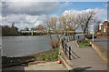

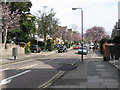


100 photos from this area
Area Information
Key information about the TW9 4AA including its size, population, and administrative classification.
- Area Type
- Postcode
- Area Size
- 1.2 hectares
- Population
- 1710
- Population Density
- 7152 people/km²
House Prices in TW9 4AA
41
Properties
£920,524
Average Sold Price
£225,000
Lowest Price
£1,775,000
Highest Price
Showing 41 properties
| Address | Type | Beds | Baths | Last Sale Price | Last Sale Date | |
|---|---|---|---|---|---|---|
| 95 Mortlake Road, Kew, TW9 4AA | Semi-detached | 4 | 2 | £1,585,000 | Feb 2025 | |
| 93 Mortlake Road, Kew, TW9 4AA | Detached | 5 | 4 | £1,775,000 | May 2024 | |
| 79 Mortlake Road, Kew, TW9 4AA | Semi-detached | 6 | 3 | £1,575,000 | Jul 2022 | |
| 57 Mortlake Road, Kew, TW9 4AA | Detached | 5 | 3 | £1,575,000 | Feb 2022 | |
| 105 Mortlake Road, Kew, TW9 4AA | house | - | - | £1,275,000 | Dec 2020 | |
| 99 Mortlake Road, Kew, TW9 4AA | Semi-detached | 6 | 2 | £1,425,000 | Nov 2019 | |
| 73 Mortlake Road, Kew, TW9 4AA | Semi-detached | 5 | 2 | £1,260,000 | Jul 2019 | |
| 81 Mortlake Road, Kew, TW9 4AA | house | 5 | 2 | £1,068,000 | Mar 2019 | |
| 83 Mortlake Road, Kew, TW9 4AA | house | 5 | 2 | £1,100,000 | Jan 2019 | |
| 63 Mortlake Road, Kew, TW9 4AA | Detached | 5 | 2 | £1,220,000 | Jul 2017 |
Page 1 of 5
Energy Efficiency in TW9 4AA
Amenities
Schools
| Rank | School | Type | Entry gender | Ages |
|---|
Explore more schools in this area
Go to Schools tabDemographics
Household Size
Family (3-5 people)
most common
Accommodation Type
Houses
most common
Tenure
85
majority
Ethnic Group
White
most common
Religion
N/A
most common
Household Composition
N/A
most common
Age
47
median
Adults (30-64 years)
most common
Household Deprivation
N/A
with no deprivation
NS-SEC
62
in Lower managerial occupations
Explore more demographic insights in this area
Go to Demographics tabPlanning
Planning Constraints
- Flood RiskPremium
- Ramsar Wetland SitesPremium
- Area of Outstanding Natural BeautyPremium
- Protected Nature ReservePremium
- Protected WoodlandPremium