Area Overview for TW9 2EQ
Photos of TW9 2EQ
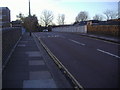
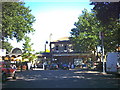
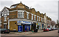
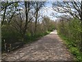
100 photos from this area
Area Information
Key information about the TW9 2EQ including its size, population, and administrative classification.
- Area Type
- Postcode
- Area Size
- 5224 m²
- Population
- 1905
- Population Density
- 9554 people/km²
House Prices in TW9 2EQ
39
Properties
£424,981
Average Sold Price
£46,000
Lowest Price
£1,000,000
Highest Price
Showing 39 properties
| Address | Type | Beds | Baths | Last Sale Price | Last Sale Date | |
|---|---|---|---|---|---|---|
| 210 Sandycombe Road, Richmond, TW9 2EQ | Flat | 1 | 1 | £957,500 | Feb 2025 | |
| 206 Sandycombe Road, Richmond, TW9 2EQ | Terraced | 3 | 2 | £1,000,000 | Nov 2023 | |
| 238A Sandycombe Road, Richmond, TW9 2EQ | Retail | - | - | £620,000 | Dec 2022 | |
| 218A Sandycombe Road, Richmond, TW9 2EQ | Flat | 3 | 1 | £446,000 | Nov 2019 | |
| 106 Sandycombe Road, Richmond, TW9 2EQ | Flat | - | - | £415,000 | Sep 2014 | |
| 230 Sandycombe Road, Richmond, TW9 2EQ | house | - | - | £410,000 | Sep 2009 | |
| 226 Sandycombe Road, Richmond, TW9 2EQ | Terraced | - | - | £500,000 | Jun 2008 | |
| 218 Sandycombe Road, Richmond, TW9 2EQ | Flat | - | - | £245,000 | Apr 2006 | |
| Flat, 216 Sandycombe Road, Richmond, TW9 2EQ | undefined | - | - | £46,000 | Jun 2000 | |
| 202 Sandycombe Road, Richmond, TW9 2EQ | house | 4 | - | £340,000 | May 2000 |
Page 1 of 4
Energy Efficiency in TW9 2EQ
Amenities
Schools
| Rank | School | Type | Entry gender | Ages |
|---|
Explore more schools in this area
Go to Schools tabDemographics
Household Size
Two person
most common
Accommodation Type
Houses
most common
Tenure
57
majority
Ethnic Group
White
most common
Religion
N/A
most common
Household Composition
N/A
most common
Age
47
median
Adults (30-64 years)
most common
Household Deprivation
N/A
with no deprivation
NS-SEC
59
in Lower managerial occupations
Explore more demographic insights in this area
Go to Demographics tabPlanning
Planning Constraints
- Flood RiskPremium
- Ramsar Wetland SitesPremium
- Area of Outstanding Natural BeautyPremium
- Protected Nature ReservePremium
- Protected WoodlandPremium