Area Overview for TW8 8JE
Photos of TW8 8JE

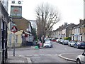

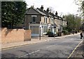
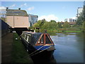


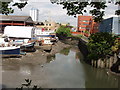


100 photos from this area
Area Information
Key information about the TW8 8JE including its size, population, and administrative classification.
- Area Type
- Postcode
- Area Size
- 1.2 hectares
- Population
- 1261
- Population Density
- 5330 people/km²
House Prices in TW8 8JE
67
Properties
£251,678
Average Sold Price
£33,200
Lowest Price
£450,000
Highest Price
Showing 67 properties
| Address | Type | Beds | Baths | Last Sale Price | Last Sale Date | |
|---|---|---|---|---|---|---|
| 81 Brent Lea, Brentford, TW8 8JE | Flat | 3 | 1 | £360,000 | Oct 2025 | |
| 77 Brent Lea, Brentford, TW8 8JE | Flat | - | - | £316,800 | Nov 2024 | |
| 103 Brent Lea, Brentford, TW8 8JE | Flat | - | - | £370,000 | Jan 2023 | |
| 119 Brent Lea, Brentford, TW8 8JE | Flat | - | - | £353,000 | Dec 2021 | |
| 91 Brent Lea, Brentford, TW8 8JE | Flat | - | - | £385,000 | Nov 2021 | |
| 96 Brent Lea, Brentford, TW8 8JE | Flat | - | - | £375,000 | Nov 2020 | |
| 59 Brent Lea, Brentford, TW8 8JE | Detached | 4 | - | £450,000 | Jun 2014 | |
| 82 Brent Lea, Brentford, TW8 8JE | Flat | 3 | 1 | £220,000 | Sep 2008 | |
| 85 Brent Lea, Brentford, TW8 8JE | Flat | 3 | 1 | £235,000 | Dec 2007 | |
| 118 Brent Lea, Brentford, TW8 8JE | Flat | - | - | £205,700 | Jul 2007 |
Page 1 of 7
Energy Efficiency in TW8 8JE
Amenities
Schools
| Rank | School | Type | Entry gender | Ages |
|---|
Explore more schools in this area
Go to Schools tabDemographics
Household Size
One person
most common
Accommodation Type
Flats
most common
Tenure
45
majority
Ethnic Group
White
most common
Religion
N/A
most common
Household Composition
N/A
most common
Age
47
median
Adults (30-64 years)
most common
Household Deprivation
N/A
with no deprivation
NS-SEC
42
in Lower managerial occupations
Explore more demographic insights in this area
Go to Demographics tabPlanning
Planning Constraints
- Flood RiskPremium
- Ramsar Wetland SitesPremium
- Area of Outstanding Natural BeautyPremium
- Protected Nature ReservePremium
- Protected WoodlandPremium