Area Overview for TW8 8DB
Photos of TW8 8DB
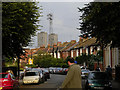
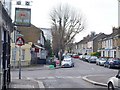
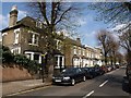
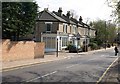
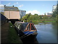
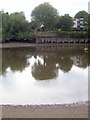
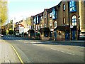
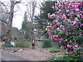
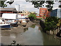
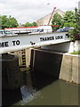
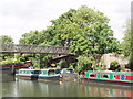
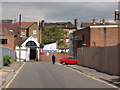
100 photos from this area
Area Information
Key information about the TW8 8DB including its size, population, and administrative classification.
- Area Type
- Postcode
- Area Size
- 9829 m²
- Population
- 1814
- Population Density
- 7179 people/km²
House Prices in TW8 8DB
32
Properties
£523,325
Average Sold Price
£112,000
Lowest Price
£860,000
Highest Price
Showing 32 properties
| Address | Type | Beds | Baths | Last Sale Price | Last Sale Date | |
|---|---|---|---|---|---|---|
| 10 Church Walk, Brentford, TW8 8DB | Terraced | 4 | 2 | £860,000 | Nov 2025 | |
| 23 Church Walk, Brentford, TW8 8DB | Semi-detached | 3 | 1 | £640,000 | Jul 2024 | |
| 7 Church Walk, Brentford, TW8 8DB | Retail | 4 | 2 | £847,500 | Mar 2022 | |
| 12 Church Walk, Brentford, TW8 8DB | Terraced | 4 | 2 | £840,000 | Jun 2021 | |
| 9 Church Walk, Brentford, TW8 8DB | Terraced | 3 | 2 | £745,000 | Feb 2021 | |
| 2 Church Walk, Brentford, TW8 8DB | house | - | - | £680,000 | Feb 2021 | |
| 4 Church Walk, Brentford, TW8 8DB | Terraced | 4 | 3 | £860,000 | Oct 2019 | |
| 27 Church Walk, Brentford, TW8 8DB | Semi-detached | 2 | 1 | £480,000 | Feb 2015 | |
| 12A Church Walk, Brentford, TW8 8DB | house | - | - | £675,000 | Oct 2014 | |
| 19 Church Walk, Brentford, TW8 8DB | Terraced | 4 | 2 | £675,000 | Oct 2014 |
Page 1 of 4
Energy Efficiency in TW8 8DB
Amenities
Schools
| Rank | School | Type | Entry gender | Ages |
|---|
Explore more schools in this area
Go to Schools tabDemographics
Household Size
One person
most common
Accommodation Type
Flats
most common
Tenure
36
majority
Ethnic Group
White
most common
Religion
N/A
most common
Household Composition
N/A
most common
Age
47
median
Adults (30-64 years)
most common
Household Deprivation
N/A
with no deprivation
NS-SEC
36
in Lower managerial occupations
Explore more demographic insights in this area
Go to Demographics tabPlanning
Planning Constraints
- Flood RiskPremium
- Ramsar Wetland SitesPremium
- Area of Outstanding Natural BeautyPremium
- Protected Nature ReservePremium
- Protected WoodlandPremium