Area Overview for TW7 7LA
Photos of TW7 7LA
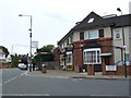

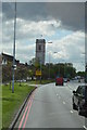
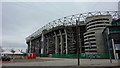
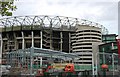
67 photos from this area
Area Information
Key information about the TW7 7LA including its size, population, and administrative classification.
- Area Type
- Postcode
- Area Size
- 1.6 hectares
- Population
- 1418
- Population Density
- 6890 people/km²
House Prices in TW7 7LA
33
Properties
£346,950
Average Sold Price
£143,000
Lowest Price
£495,000
Highest Price
Showing 33 properties
| Address | Type | Beds | Baths | Last Sale Price | Last Sale Date | |
|---|---|---|---|---|---|---|
| 2 Harlequin Close, Isleworth, TW7 7LA | Terraced | 3 | 2 | £495,000 | Mar 2025 | |
| 18 Harlequin Close, Isleworth, TW7 7LA | house | 3 | 2 | £480,000 | Aug 2021 | |
| 25 Harlequin Close, Isleworth, TW7 7LA | house | 3 | - | £450,000 | Jun 2021 | |
| 30 Harlequin Close, Isleworth, TW7 7LA | Semi-detached | 2 | 1 | £430,000 | Jun 2019 | |
| 8 Harlequin Close, Isleworth, TW7 7LA | Terraced | 2 | 1 | £410,000 | Feb 2019 | |
| 13 Harlequin Close, Isleworth, TW7 7LA | Terraced | 3 | 1 | £400,000 | Oct 2016 | |
| 19 Harlequin Close, Isleworth, TW7 7LA | house | - | - | £235,000 | Oct 2006 | |
| 16 Harlequin Close, Isleworth, TW7 7LA | house | - | - | £216,500 | Jul 2003 | |
| 20 Harlequin Close, Isleworth, TW7 7LA | Semi-detached | 3 | 1 | £210,000 | Dec 2002 | |
| 14 Harlequin Close, Isleworth, TW7 7LA | Terraced | - | - | £143,000 | Dec 2000 |
Page 1 of 4
Energy Efficiency in TW7 7LA
Amenities
Schools
| Rank | School | Type | Entry gender | Ages |
|---|
Explore more schools in this area
Go to Schools tabDemographics
Household Size
Family (3-5 people)
most common
Accommodation Type
Houses
most common
Tenure
72
majority
Ethnic Group
White
most common
Religion
N/A
most common
Household Composition
N/A
most common
Age
47
median
Adults (30-64 years)
most common
Household Deprivation
N/A
with no deprivation
NS-SEC
36
in Lower managerial occupations
Explore more demographic insights in this area
Go to Demographics tabPlanning
Planning Constraints
- Flood RiskPremium
- Ramsar Wetland SitesPremium
- Area of Outstanding Natural BeautyPremium
- Protected Nature ReservePremium
- Protected WoodlandPremium