Area Overview for TW7 5PG
Photos of TW7 5PG

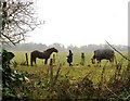

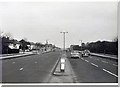
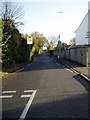
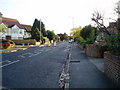


74 photos from this area
Area Information
Key information about the TW7 5PG including its size, population, and administrative classification.
- Area Type
- Postcode
- Area Size
- 8146 m²
- Population
- 2052
- Population Density
- 556 people/km²
House Prices in TW7 5PG
48
Properties
£190,150
Average Sold Price
£41,500
Lowest Price
£446,146
Highest Price
Showing 48 properties
| Address | Type | Beds | Baths | Last Sale Price | Last Sale Date | |
|---|---|---|---|---|---|---|
| 44 Stags Way, Isleworth, TW7 5PG | Flat | - | - | £285,000 | Oct 2024 | |
| 16 Stags Way, Isleworth, TW7 5PG | Flat | - | - | £245,000 | Feb 2023 | |
| 17 Stags Way, Isleworth, TW7 5PG | Flat | - | - | £350,000 | Jul 2022 | |
| 39 Stags Way, Isleworth, TW7 5PG | Flat | 1 | 1 | £260,000 | Dec 2021 | |
| 14 Stags Way, Isleworth, TW7 5PG | Flat | 1 | 1 | £306,000 | Sep 2017 | |
| 33 Stags Way, Isleworth, TW7 5PG | Flat | - | - | £302,000 | Sep 2017 | |
| 7 Stags Way, Isleworth, TW7 5PG | house | - | - | £446,146 | Apr 2016 | |
| 22 Stags Way, Isleworth, TW7 5PG | Flat | - | - | £300,000 | Aug 2014 | |
| 29 Stags Way, Isleworth, TW7 5PG | Flat | - | - | £195,000 | Oct 2013 | |
| 9 Stags Way, Isleworth, TW7 5PG | Flat | 1 | 1 | £200,000 | Jan 2010 |
Page 1 of 5
Energy Efficiency in TW7 5PG
Amenities
Schools
| Rank | School | Type | Entry gender | Ages |
|---|
Explore more schools in this area
Go to Schools tabDemographics
Household Size
Family (3-5 people)
most common
Accommodation Type
Houses
most common
Tenure
54
majority
Ethnic Group
asian_total
most common
Religion
N/A
most common
Household Composition
N/A
most common
Age
47
median
Adults (30-64 years)
most common
Household Deprivation
N/A
with no deprivation
NS-SEC
41
in Lower managerial occupations
Explore more demographic insights in this area
Go to Demographics tabPlanning
Planning Constraints
- Flood RiskPremium
- Ramsar Wetland SitesPremium
- Area of Outstanding Natural BeautyPremium
- Protected Nature ReservePremium
- Protected WoodlandPremium