Area Overview for TW5 9SJ
Photos of TW5 9SJ
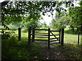
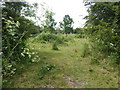
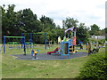
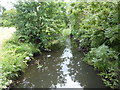
80 photos from this area
Area Information
Key information about the TW5 9SJ including its size, population, and administrative classification.
- Area Type
- Postcode
- Area Size
- 1.8 hectares
- Population
- 2125
- Population Density
- 6477 people/km²
House Prices in TW5 9SJ
49
Properties
£234,123
Average Sold Price
£50,000
Lowest Price
£500,000
Highest Price
Showing 49 properties
| Address | Type | Beds | Baths | Last Sale Price | Last Sale Date | |
|---|---|---|---|---|---|---|
| 259 Waye Avenue, Hounslow, TW5 9SJ | Terraced | 3 | 2 | £380,000 | Jul 2025 | |
| 233 Waye Avenue, Hounslow, TW5 9SJ | Terraced | 3 | 2 | £499,950 | May 2024 | |
| 229 Waye Avenue, Hounslow, TW5 9SJ | house | - | - | £500,000 | May 2023 | |
| 223 Waye Avenue, Hounslow, TW5 9SJ | Terraced | 3 | 2 | £395,000 | Feb 2018 | |
| 291 Waye Avenue, Hounslow, TW5 9SJ | Terraced | 4 | 2 | £295,000 | May 2017 | |
| 221 Waye Avenue, Hounslow, TW5 9SJ | Terraced | 4 | 3 | £360,000 | Aug 2015 | |
| 251 Waye Avenue, Hounslow, TW5 9SJ | Semi-detached | 4 | - | £345,000 | Jan 2015 | |
| 247 Waye Avenue, Hounslow, TW5 9SJ | Terraced | 3 | 2 | £290,000 | Jul 2014 | |
| 287 Waye Avenue, Hounslow, TW5 9SJ | Terraced | - | - | £174,750 | Jun 2014 | |
| 269 Waye Avenue, Hounslow, TW5 9SJ | Terraced | 4 | 2 | £250,000 | Dec 2009 |
Page 1 of 5
Energy Efficiency in TW5 9SJ
Amenities
Schools
| Rank | School | Type | Entry gender | Ages |
|---|
Explore more schools in this area
Go to Schools tabDemographics
Household Size
Family (3-5 people)
most common
Accommodation Type
Houses
most common
Tenure
40
majority
Ethnic Group
asian_total
most common
Religion
N/A
most common
Household Composition
N/A
most common
Age
47
median
Adults (30-64 years)
most common
Household Deprivation
N/A
with no deprivation
NS-SEC
17
in Lower managerial occupations
Explore more demographic insights in this area
Go to Demographics tabPlanning
Planning Constraints
- Flood RiskPremium
- Ramsar Wetland SitesPremium
- Area of Outstanding Natural BeautyPremium
- Protected Nature ReservePremium
- Protected WoodlandPremium