Area Overview for TW5 9HA
Photos of TW5 9HA
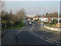
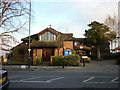
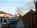
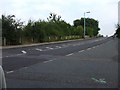

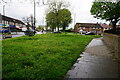
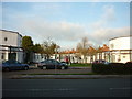
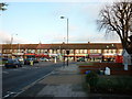
41 photos from this area
Area Information
Key information about the TW5 9HA including its size, population, and administrative classification.
- Area Type
- Postcode
- Area Size
- 5913 m²
- Population
- 1918
- Population Density
- 5226 people/km²
House Prices in TW5 9HA
17
Properties
£354,357
Average Sold Price
£80,500
Lowest Price
£625,000
Highest Price
Showing 17 properties
| Address | Type | Beds | Baths | Last Sale Price | Last Sale Date | |
|---|---|---|---|---|---|---|
| 65 Cranford Lane, Hounslow, TW5 9HA | house | 4 | 1 | £625,000 | Jan 2022 | |
| 69 Cranford Lane, Hounslow, TW5 9HA | Semi-detached | 3 | 1 | £525,000 | Jan 2018 | |
| 71 Cranford Lane, Hounslow, TW5 9HA | Semi-detached | 4 | 1 | £355,000 | Jun 2014 | |
| 61 Cranford Lane, Hounslow, TW5 9HA | Semi-detached | 3 | - | £340,000 | Dec 2011 | |
| 81 Cranford Lane, Hounslow, TW5 9HA | house | - | - | £375,000 | Sep 2010 | |
| 77 Cranford Lane, Hounslow, TW5 9HA | house | - | - | £180,000 | Oct 2001 | |
| 51 Cranford Lane, Hounslow, TW5 9HA | Detached | 3 | 2 | £80,500 | Oct 1995 | |
| 79A Cranford Lane, Hounslow, TW5 9HA | Detached | 5 | 3 | - | - | |
| Flat Ground Floor, 47 Cranford Lane, Hounslow, TW5 9HA | Detached | 5 | 4 | - | - | |
| 79 Cranford Lane, Hounslow, TW5 9HA | Flat | 3 | - | - | - |
Page 1 of 2
Energy Efficiency in TW5 9HA
Amenities
Schools
| Rank | School | Type | Entry gender | Ages |
|---|
Explore more schools in this area
Go to Schools tabDemographics
Household Size
Family (3-5 people)
most common
Accommodation Type
Houses
most common
Tenure
55
majority
Ethnic Group
asian_total
most common
Religion
N/A
most common
Household Composition
N/A
most common
Age
47
median
Adults (30-64 years)
most common
Household Deprivation
N/A
with no deprivation
NS-SEC
25
in Lower managerial occupations
Explore more demographic insights in this area
Go to Demographics tabPlanning
Planning Constraints
- Flood RiskPremium
- Ramsar Wetland SitesPremium
- Area of Outstanding Natural BeautyPremium
- Protected Nature ReservePremium
- Protected WoodlandPremium