Area Overview for TW5 9AU
Photos of TW5 9AU
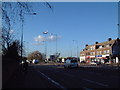
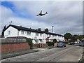
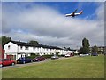


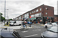
48 photos from this area
Area Information
Key information about the TW5 9AU including its size, population, and administrative classification.
- Area Type
- Postcode
- Area Size
- 1.0 hectares
- Population
- 2001
- Population Density
- 3773 people/km²
House Prices in TW5 9AU
60
Properties
£163,920
Average Sold Price
£42,000
Lowest Price
£290,000
Highest Price
Showing 60 properties
| Address | Type | Beds | Baths | Last Sale Price | Last Sale Date | |
|---|---|---|---|---|---|---|
| 20, Parklands Court, Great West Road, Hounslow, TW5 9AU | Flat | - | - | £251,000 | Aug 2023 | |
| 5, Parklands Court, Great West Road, Hounslow, TW5 9AU | Flat | - | - | £290,000 | Jul 2023 | |
| 6, Parklands Court, Great West Road, Hounslow, TW5 9AU | Flat | 2 | 1 | £264,500 | May 2023 | |
| 11, Parklands Court, Great West Road, Hounslow, TW5 9AU | Flat | - | - | £240,000 | May 2023 | |
| 8, Parklands Court, Great West Road, Hounslow, TW5 9AU | Flat | 2 | 1 | £265,000 | Apr 2022 | |
| 36, Parklands Court, Great West Road, Hounslow, TW5 9AU | Flat | - | - | £270,000 | Dec 2021 | |
| 32, Parklands Court, Great West Road, Hounslow, TW5 9AU | Flat | - | - | £250,000 | Nov 2020 | |
| 1, Parklands Court, Great West Road, Hounslow, TW5 9AU | Flat | 2 | 1 | £250,000 | Apr 2020 | |
| 19, Parklands Court, Great West Road, Hounslow, TW5 9AU | Flat | 2 | - | £234,000 | Mar 2017 | |
| 46, Parklands Court, Great West Road, Hounslow, TW5 9AU | Flat | - | - | £226,000 | Nov 2015 |
Page 1 of 6
Energy Efficiency in TW5 9AU
Amenities
Schools
| Rank | School | Type | Entry gender | Ages |
|---|
Explore more schools in this area
Go to Schools tabDemographics
Household Size
Family (3-5 people)
most common
Accommodation Type
Houses
most common
Tenure
54
majority
Ethnic Group
asian_total
most common
Religion
N/A
most common
Household Composition
N/A
most common
Age
47
median
Adults (30-64 years)
most common
Household Deprivation
N/A
with no deprivation
NS-SEC
24
in Lower managerial occupations
Explore more demographic insights in this area
Go to Demographics tabPlanning
Planning Constraints
- Flood RiskPremium
- Ramsar Wetland SitesPremium
- Area of Outstanding Natural BeautyPremium
- Protected Nature ReservePremium
- Protected WoodlandPremium