Area Overview for TW5 0PW
Photos of TW5 0PW


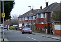
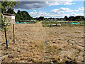
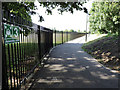
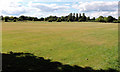
65 photos from this area
Area Information
Key information about the TW5 0PW including its size, population, and administrative classification.
- Area Type
- Postcode
- Area Size
- 1.3 hectares
- Population
- 2169
- Population Density
- 6119 people/km²
House Prices in TW5 0PW
27
Properties
£507,056
Average Sold Price
£295,000
Lowest Price
£900,000
Highest Price
Showing 27 properties
| Address | Type | Beds | Baths | Last Sale Price | Last Sale Date | |
|---|---|---|---|---|---|---|
| 22 Camborne Way, Hounslow, TW5 0PW | Semi-detached | 4 | 2 | £690,000 | May 2024 | |
| 11 Camborne Way, Hounslow, TW5 0PW | Detached | 4 | 3 | £770,000 | Feb 2023 | |
| 19 Camborne Way, Hounslow, TW5 0PW | Semi-detached | 4 | 1 | £725,000 | Oct 2022 | |
| 9 Camborne Way, Hounslow, TW5 0PW | house | - | - | £900,000 | Sep 2022 | |
| 4 Camborne Way, Hounslow, TW5 0PW | Terraced | - | - | £645,000 | Dec 2019 | |
| 3 Camborne Way, Hounslow, TW5 0PW | Bungalow | 3 | 1 | £420,000 | Jan 2019 | |
| 1 Camborne Way, Hounslow, TW5 0PW | Bungalow | 3 | 1 | £450,000 | Jul 2018 | |
| 21 Camborne Way, Hounslow, TW5 0PW | Semi-detached | 3 | 2 | £565,000 | Jan 2017 | |
| 17 Camborne Way, Hounslow, TW5 0PW | house | - | - | £380,000 | Jun 2013 | |
| 10 Camborne Way, Hounslow, TW5 0PW | Bungalow | 4 | 1 | £499,950 | Oct 2009 |
Page 1 of 3
Energy Efficiency in TW5 0PW
Amenities
Schools
| Rank | School | Type | Entry gender | Ages |
|---|
Explore more schools in this area
Go to Schools tabDemographics
Household Size
Family (3-5 people)
most common
Accommodation Type
Houses
most common
Tenure
60
majority
Ethnic Group
asian_total
most common
Religion
N/A
most common
Household Composition
N/A
most common
Age
47
median
Adults (30-64 years)
most common
Household Deprivation
N/A
with no deprivation
NS-SEC
26
in Lower managerial occupations
Explore more demographic insights in this area
Go to Demographics tabPlanning
Planning Constraints
- Flood RiskPremium
- Ramsar Wetland SitesPremium
- Area of Outstanding Natural BeautyPremium
- Protected Nature ReservePremium
- Protected WoodlandPremium