Area Overview for TW5 0AA
Photos of TW5 0AA

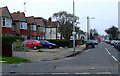
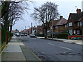
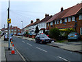
68 photos from this area
Area Information
Key information about the TW5 0AA including its size, population, and administrative classification.
- Area Type
- Postcode
- Area Size
- 9940 m²
- Population
- 1925
- Population Density
- 9587 people/km²
House Prices in TW5 0AA
51
Properties
£218,750
Average Sold Price
£110,000
Lowest Price
£365,000
Highest Price
Showing 51 properties
| Address | Type | Beds | Baths | Last Sale Price | Last Sale Date | |
|---|---|---|---|---|---|---|
| 137 Vicarage Farm Road, Hounslow, TW5 0AA | Semi-detached | - | - | £365,000 | Jun 2006 | |
| 133 Vicarage Farm Road, Hounslow, TW5 0AA | house | - | - | £250,000 | Oct 2004 | |
| 123 Vicarage Farm Road, Hounslow, TW5 0AA | Semi-detached | - | - | £150,000 | Oct 2001 | |
| 135 Vicarage Farm Road, Hounslow, TW5 0AA | Semi-detached | 3 | 2 | £110,000 | Oct 1997 | |
| 127 Vicarage Farm Road, Hounslow, TW5 0AA | Semi-detached | - | - | - | - | |
| 117 Vicarage Farm Road, Hounslow, TW5 0AA | Semi-detached | 4 | 1 | - | - | |
| 125 Vicarage Farm Road, Hounslow, TW5 0AA | Semi-detached | - | - | - | - | |
| 131 Vicarage Farm Road, Hounslow, TW5 0AA | Semi-detached | 3 | - | - | - | |
| 119 Vicarage Farm Road, Hounslow, TW5 0AA | Semi-detached | - | - | - | - | |
| 115 Vicarage Farm Road, Hounslow, TW5 0AA | Semi-detached | - | - | - | - |
Page 1 of 6
Energy Efficiency in TW5 0AA
Amenities
Schools
| Rank | School | Type | Entry gender | Ages |
|---|
Explore more schools in this area
Go to Schools tabDemographics
Household Size
Family (3-5 people)
most common
Accommodation Type
Houses
most common
Tenure
43
majority
Ethnic Group
asian_total
most common
Religion
N/A
most common
Household Composition
N/A
most common
Age
47
median
Adults (30-64 years)
most common
Household Deprivation
N/A
with no deprivation
NS-SEC
21
in Lower managerial occupations
Explore more demographic insights in this area
Go to Demographics tabPlanning
Planning Constraints
- Flood RiskPremium
- Ramsar Wetland SitesPremium
- Area of Outstanding Natural BeautyPremium
- Protected Nature ReservePremium
- Protected WoodlandPremium