Area Overview for TW4 7RT
Photos of TW4 7RT
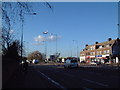
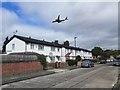
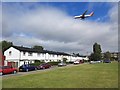
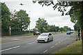
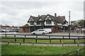
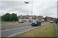
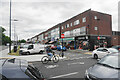
48 photos from this area
Area Information
Key information about the TW4 7RT including its size, population, and administrative classification.
- Area Type
- Postcode
- Area Size
- 8405 m²
- Population
- 2386
- Population Density
- 10604 people/km²
House Prices in TW4 7RT
29
Properties
£367,550
Average Sold Price
£115,500
Lowest Price
£535,000
Highest Price
Showing 29 properties
| Address | Type | Beds | Baths | Last Sale Price | Last Sale Date | |
|---|---|---|---|---|---|---|
| 47 Legrace Avenue, Hounslow, TW4 7RT | house | - | - | £535,000 | Mar 2025 | |
| 55A Legrace Avenue, Hounslow, TW4 7RT | Terraced | 2 | 1 | £400,000 | Mar 2023 | |
| 31 Legrace Avenue, Hounslow, TW4 7RT | Semi-detached | 3 | 1 | £470,000 | Dec 2021 | |
| 17 Legrace Avenue, Hounslow, TW4 7RT | house | - | - | £485,000 | Jan 2021 | |
| 55 Legrace Avenue, Hounslow, TW4 7RT | Terraced | 2 | 1 | £370,000 | Feb 2020 | |
| 37 Legrace Avenue, Hounslow, TW4 7RT | Semi-detached | 4 | - | £500,000 | Jun 2018 | |
| 43 Legrace Avenue, Hounslow, TW4 7RT | Semi-detached | - | - | £325,000 | Aug 2012 | |
| 9 Legrace Avenue, Hounslow, TW4 7RT | Semi-detached | - | - | £225,000 | Jun 2009 | |
| 41 Legrace Avenue, Hounslow, TW4 7RT | Semi-detached | - | - | £250,000 | Aug 2008 | |
| 23 Legrace Avenue, Hounslow, TW4 7RT | Terraced | - | - | £115,500 | Aug 1998 |
Page 1 of 3
Energy Efficiency in TW4 7RT
Amenities
Schools
| Rank | School | Type | Entry gender | Ages |
|---|
Explore more schools in this area
Go to Schools tabDemographics
Household Size
Family (3-5 people)
most common
Accommodation Type
Houses
most common
Tenure
45
majority
Ethnic Group
asian_total
most common
Religion
N/A
most common
Household Composition
N/A
most common
Age
47
median
Adults (30-64 years)
most common
Household Deprivation
N/A
with no deprivation
NS-SEC
21
in Lower managerial occupations
Explore more demographic insights in this area
Go to Demographics tabPlanning
Planning Constraints
- Flood RiskPremium
- Ramsar Wetland SitesPremium
- Area of Outstanding Natural BeautyPremium
- Protected Nature ReservePremium
- Protected WoodlandPremium