Area Overview for TW4 7PS
Photos of TW4 7PS

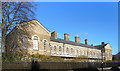
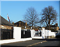

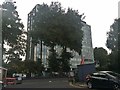
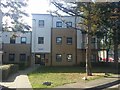
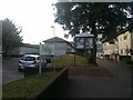
45 photos from this area
Area Information
Key information about the TW4 7PS including its size, population, and administrative classification.
- Area Type
- Postcode
- Area Size
- 3145 m²
- Population
- 2026
- Population Density
- 14258 people/km²
House Prices in TW4 7PS
40
Properties
£117,158
Average Sold Price
£59,000
Lowest Price
£207,000
Highest Price
Showing 40 properties
| Address | Type | Beds | Baths | Last Sale Price | Last Sale Date | |
|---|---|---|---|---|---|---|
| 120 Marmot Road, Hounslow, TW4 7PS | Maisonette | 2 | - | £207,000 | Mar 2017 | |
| 112 Marmot Road, Hounslow, TW4 7PS | Flat | 2 | 1 | £178,000 | Jul 2015 | |
| 80 Marmot Road, Hounslow, TW4 7PS | Flat | - | - | £139,950 | Jul 2005 | |
| 124 Marmot Road, Hounslow, TW4 7PS | house | - | - | £59,000 | Mar 2002 | |
| 144 Marmot Road, Hounslow, TW4 7PS | Flat | - | - | £60,000 | Jun 2001 | |
| 136 Marmot Road, Hounslow, TW4 7PS | Flat | - | - | £59,000 | Dec 2000 | |
| 88 Marmot Road, Hounslow, TW4 7PS | Flat | - | - | - | - | |
| 134 Marmot Road, Hounslow, TW4 7PS | Flat | - | - | - | - | |
| 100 Marmot Road, Hounslow, TW4 7PS | Maisonette | - | - | - | - | |
| 104 Marmot Road, Hounslow, TW4 7PS | Flat | - | - | - | - |
Page 1 of 4
Energy Efficiency in TW4 7PS
Amenities
Schools
| Rank | School | Type | Entry gender | Ages |
|---|
Explore more schools in this area
Go to Schools tabDemographics
Household Size
Family (3-5 people)
most common
Accommodation Type
Flats
most common
Tenure
13
majority
Ethnic Group
White
most common
Religion
N/A
most common
Household Composition
N/A
most common
Age
47
median
Adults (30-64 years)
most common
Household Deprivation
N/A
with no deprivation
NS-SEC
19
in Lower managerial occupations
Explore more demographic insights in this area
Go to Demographics tabPlanning
Planning Constraints
- Flood RiskPremium
- Ramsar Wetland SitesPremium
- Area of Outstanding Natural BeautyPremium
- Protected Nature ReservePremium
- Protected WoodlandPremium