Area Overview for TW4 5QN
Photos of TW4 5QN


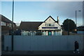
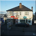
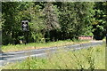
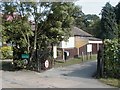
48 photos from this area
Area Information
Key information about the TW4 5QN including its size, population, and administrative classification.
- Area Type
- Postcode
- Area Size
- 4724 m²
- Population
- 2161
- Population Density
- 7442 people/km²
House Prices in TW4 5QN
40
Properties
£143,350
Average Sold Price
£44,950
Lowest Price
£237,500
Highest Price
Showing 40 properties
| Address | Type | Beds | Baths | Last Sale Price | Last Sale Date | |
|---|---|---|---|---|---|---|
| 131 Edgar Road, Whitton, TW4 5QN | Retail | 2 | 1 | £210,000 | Apr 2023 | |
| 129 Edgar Road, Whitton, TW4 5QN | Maisonette | - | - | £237,500 | Aug 2021 | |
| 145 Edgar Road, Whitton, TW4 5QN | Flat | - | - | £175,000 | Oct 2013 | |
| 187 Edgar Road, Whitton, TW4 5QN | Maisonette | - | - | £137,500 | Feb 2006 | |
| 143 Edgar Road, Whitton, TW4 5QN | Flat | - | - | £144,000 | May 2004 | |
| 167 Edgar Road, Whitton, TW4 5QN | Flat | - | - | £54,500 | Mar 2003 | |
| 115 Edgar Road, Whitton, TW4 5QN | Flat | - | - | £44,950 | Aug 1996 | |
| 125 Edgar Road, Whitton, TW4 5QN | Flat | - | - | - | - | |
| 165 Edgar Road, Whitton, TW4 5QN | Flat | - | - | - | - | |
| 155 Edgar Road, Whitton, TW4 5QN | Maisonette | - | - | - | - |
Page 1 of 4
Energy Efficiency in TW4 5QN
Amenities
Schools
| Rank | School | Type | Entry gender | Ages |
|---|
Explore more schools in this area
Go to Schools tabDemographics
Household Size
Family (3-5 people)
most common
Accommodation Type
Flats
most common
Tenure
36
majority
Ethnic Group
White
most common
Religion
N/A
most common
Household Composition
N/A
most common
Age
47
median
Adults (30-64 years)
most common
Household Deprivation
N/A
with no deprivation
NS-SEC
24
in Lower managerial occupations
Explore more demographic insights in this area
Go to Demographics tabPlanning
Planning Constraints
- Flood RiskPremium
- Ramsar Wetland SitesPremium
- Area of Outstanding Natural BeautyPremium
- Protected Nature ReservePremium
- Protected WoodlandPremium