Area Overview for TW4 5BQ
Photos of TW4 5BQ
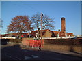
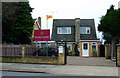
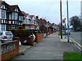
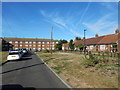
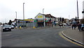
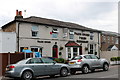
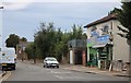
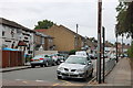
74 photos from this area
Area Information
Key information about the TW4 5BQ including its size, population, and administrative classification.
- Area Type
- Postcode
- Area Size
- 1.2 hectares
- Population
- 2525
- Population Density
- 1479 people/km²
House Prices in TW4 5BQ
45
Properties
£260,026
Average Sold Price
£74,500
Lowest Price
£495,000
Highest Price
Showing 45 properties
| Address | Type | Beds | Baths | Last Sale Price | Last Sale Date | |
|---|---|---|---|---|---|---|
| 26 Munster Avenue, Hounslow, TW4 5BQ | Retail | 3 | - | £462,000 | Dec 2022 | |
| 70 Munster Avenue, Hounslow, TW4 5BQ | Retail | 3 | 1 | £495,000 | Mar 2022 | |
| 50 Munster Avenue, Hounslow, TW4 5BQ | Semi-detached | 3 | - | £380,000 | Jul 2019 | |
| 32 Munster Avenue, Hounslow, TW4 5BQ | Semi-detached | - | - | £430,000 | Oct 2017 | |
| 6 Munster Avenue, Hounslow, TW4 5BQ | Semi-detached | 3 | - | £405,000 | Mar 2016 | |
| 42 Munster Avenue, Hounslow, TW4 5BQ | house | 1 | 3 | £249,000 | Jul 2008 | |
| 76 Munster Avenue, Hounslow, TW4 5BQ | Semi-detached | - | - | £310,000 | Oct 2007 | |
| 2 Munster Avenue, Hounslow, TW4 5BQ | house | - | - | £340,000 | Apr 2004 | |
| 40 Munster Avenue, Hounslow, TW4 5BQ | Semi-detached | 5 | 2 | £249,950 | Aug 2003 | |
| 30 Munster Avenue, Hounslow, TW4 5BQ | Semi-detached | - | - | £250,000 | Jun 2003 |
Page 1 of 5
Energy Efficiency in TW4 5BQ
Amenities
Schools
| Rank | School | Type | Entry gender | Ages |
|---|
Explore more schools in this area
Go to Schools tabDemographics
Household Size
Family (3-5 people)
most common
Accommodation Type
Houses
most common
Tenure
44
majority
Ethnic Group
asian_total
most common
Religion
N/A
most common
Household Composition
N/A
most common
Age
47
median
Adults (30-64 years)
most common
Household Deprivation
N/A
with no deprivation
NS-SEC
23
in Lower managerial occupations
Explore more demographic insights in this area
Go to Demographics tabPlanning
Planning Constraints
- Flood RiskPremium
- Ramsar Wetland SitesPremium
- Area of Outstanding Natural BeautyPremium
- Protected Nature ReservePremium
- Protected WoodlandPremium