Area Overview for TW3 4LA
Photos of TW3 4LA
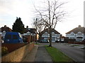
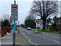
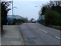

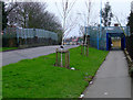
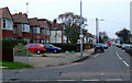
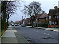
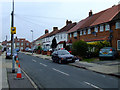
68 photos from this area
Area Information
Key information about the TW3 4LA including its size, population, and administrative classification.
- Area Type
- Postcode
- Area Size
- 1.4 hectares
- Population
- 2007
- Population Density
- 7069 people/km²
House Prices in TW3 4LA
22
Properties
£354,544
Average Sold Price
£169,950
Lowest Price
£630,000
Highest Price
Showing 22 properties
| Address | Type | Beds | Baths | Last Sale Price | Last Sale Date | |
|---|---|---|---|---|---|---|
| 71 Sutton Lane, Hounslow, TW3 4LA | house | 2 | 1 | £630,000 | Nov 2022 | |
| 81 Sutton Lane, Hounslow, TW3 4LA | Terraced | 3 | 1 | £425,000 | Nov 2021 | |
| 79 Sutton Lane, Hounslow, TW3 4LA | Semi-detached | 1 | 1 | £265,000 | May 2019 | |
| 63 Sutton Lane, Hounslow, TW3 4LA | Terraced | 3 | 1 | £450,000 | May 2019 | |
| 73 Sutton Lane, Hounslow, TW3 4LA | Semi-detached | 3 | 1 | £410,000 | Feb 2018 | |
| 59 Sutton Lane, Hounslow, TW3 4LA | Terraced | 3 | 1 | £394,950 | Nov 2016 | |
| 61 Sutton Lane, Hounslow, TW3 4LA | house | - | - | £239,000 | Sep 2009 | |
| 85 Sutton Lane, Hounslow, TW3 4LA | Flat | 1 | 1 | £169,950 | Jan 2007 | |
| 65 Sutton Lane, Hounslow, TW3 4LA | Terraced | - | - | £207,000 | Mar 2004 | |
| 67 Sutton Lane, Hounslow, TW3 4LA | house | - | - | - | - |
Page 1 of 3
Energy Efficiency in TW3 4LA
Amenities
Schools
| Rank | School | Type | Entry gender | Ages |
|---|
Explore more schools in this area
Go to Schools tabDemographics
Household Size
Family (3-5 people)
most common
Accommodation Type
Houses
most common
Tenure
47
majority
Ethnic Group
asian_total
most common
Religion
N/A
most common
Household Composition
N/A
most common
Age
47
median
Adults (30-64 years)
most common
Household Deprivation
N/A
with no deprivation
NS-SEC
24
in Lower managerial occupations
Explore more demographic insights in this area
Go to Demographics tabPlanning
Planning Constraints
- Flood RiskPremium
- Ramsar Wetland SitesPremium
- Area of Outstanding Natural BeautyPremium
- Protected Nature ReservePremium
- Protected WoodlandPremium