Area Overview for TW3 4DL
Photos of TW3 4DL

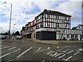
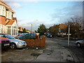
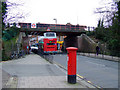
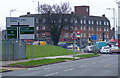

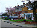
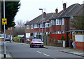
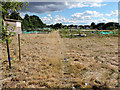
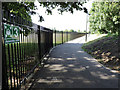
65 photos from this area
Area Information
Key information about the TW3 4DL including its size, population, and administrative classification.
- Area Type
- Postcode
- Area Size
- 2921 m²
- Population
- 2691
- Population Density
- 13191 people/km²
House Prices in TW3 4DL
12
Properties
£283,222
Average Sold Price
£107,500
Lowest Price
£425,000
Highest Price
Showing 12 properties
| Address | Type | Beds | Baths | Last Sale Price | Last Sale Date | |
|---|---|---|---|---|---|---|
| 9, Alexandra Court, Lampton Road, Hounslow, TW3 4DL | Terraced | 4 | 2 | £425,000 | Mar 2024 | |
| 6, Alexandra Court, Lampton Road, Hounslow, TW3 4DL | Terraced | 3 | 1 | £425,000 | Nov 2018 | |
| 8, Alexandra Court, Lampton Road, Hounslow, TW3 4DL | Terraced | 3 | 1 | £390,000 | Jul 2018 | |
| 12, Alexandra Court, Lampton Road, Hounslow, TW3 4DL | house | 4 | 2 | £390,000 | Oct 2016 | |
| 7, Alexandra Court, Lampton Road, Hounslow, TW3 4DL | house | 3 | - | £295,000 | May 2014 | |
| 3, Alexandra Court, Lampton Road, Hounslow, TW3 4DL | Terraced | 3 | - | £250,000 | May 2013 | |
| 2, Alexandra Court, Lampton Road, Hounslow, TW3 4DL | house | - | - | £156,500 | Aug 2001 | |
| 1, Alexandra Court, Lampton Road, Hounslow, TW3 4DL | Terraced | 3 | 1 | £110,000 | Oct 1999 | |
| 10, Alexandra Court, Lampton Road, Hounslow, TW3 4DL | Terraced | - | - | £107,500 | Aug 1999 | |
| 4, Alexandra Court, Lampton Road, Hounslow, TW3 4DL | Terraced | - | - | - | - |
Page 1 of 2
Energy Efficiency in TW3 4DL
Amenities
Schools
| Rank | School | Type | Entry gender | Ages |
|---|
Explore more schools in this area
Go to Schools tabDemographics
Household Size
Family (3-5 people)
most common
Accommodation Type
Flats
most common
Tenure
26
majority
Ethnic Group
asian_total
most common
Religion
N/A
most common
Household Composition
N/A
most common
Age
47
median
Adults (30-64 years)
most common
Household Deprivation
N/A
with no deprivation
NS-SEC
28
in Lower managerial occupations
Explore more demographic insights in this area
Go to Demographics tabPlanning
Planning Constraints
- Flood RiskPremium
- Ramsar Wetland SitesPremium
- Area of Outstanding Natural BeautyPremium
- Protected Nature ReservePremium
- Protected WoodlandPremium