Area Overview for TW3 3PT
Photos of TW3 3PT
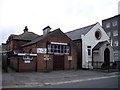
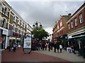
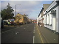
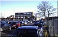

100 photos from this area
Area Information
Key information about the TW3 3PT including its size, population, and administrative classification.
- Area Type
- Postcode
- Area Size
- 9711 m²
- Population
- 1657
- Population Density
- 13516 people/km²
House Prices in TW3 3PT
61
Properties
£260,052
Average Sold Price
£50,000
Lowest Price
£635,000
Highest Price
Showing 61 properties
| Address | Type | Beds | Baths | Last Sale Price | Last Sale Date | |
|---|---|---|---|---|---|---|
| 148 Grove Road, Hounslow, TW3 3PT | Semi-detached | 3 | 1 | £350,000 | Sep 2025 | |
| Annexe 2, 82 Grove Road, Hounslow, TW3 3PT | Detached | 3 | 2 | £482,500 | Feb 2025 | |
| 86 Grove Road, Hounslow, TW3 3PT | Semi-detached | 3 | 2 | £560,000 | Feb 2023 | |
| 126 Grove Road, Hounslow, TW3 3PT | house | - | - | £385,000 | Jun 2021 | |
| 74 Grove Road, Hounslow, TW3 3PT | house | - | - | £635,000 | Feb 2021 | |
| 106 Grove Road, Hounslow, TW3 3PT | Terraced | 3 | 1 | £350,000 | Feb 2019 | |
| 108 Grove Road, Hounslow, TW3 3PT | house | - | - | £375,000 | Nov 2017 | |
| 112 Grove Road, Hounslow, TW3 3PT | Detached | 3 | 3 | £376,000 | Jun 2017 | |
| 114 Grove Road, Hounslow, TW3 3PT | Semi-detached | 3 | - | £230,000 | Aug 2010 | |
| 144 Grove Road, Hounslow, TW3 3PT | Semi-detached | 3 | 1 | £249,500 | Mar 2010 |
Page 1 of 7
Energy Efficiency in TW3 3PT
Amenities
Schools
| Rank | School | Type | Entry gender | Ages |
|---|
Explore more schools in this area
Go to Schools tabDemographics
Household Size
Family (3-5 people)
most common
Accommodation Type
Flats
most common
Tenure
27
majority
Ethnic Group
asian_total
most common
Religion
N/A
most common
Household Composition
N/A
most common
Age
47
median
Adults (30-64 years)
most common
Household Deprivation
N/A
with no deprivation
NS-SEC
21
in Lower managerial occupations
Explore more demographic insights in this area
Go to Demographics tabPlanning
Planning Constraints
- Flood RiskPremium
- Ramsar Wetland SitesPremium
- Area of Outstanding Natural BeautyPremium
- Protected Nature ReservePremium
- Protected WoodlandPremium