Area Overview for TW3 2PN
Photos of TW3 2PN
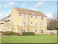
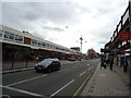
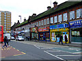
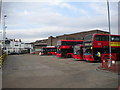
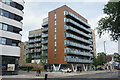
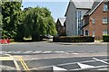
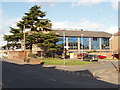
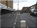
56 photos from this area
Area Information
Key information about the TW3 2PN including its size, population, and administrative classification.
- Area Type
- Postcode
- Area Size
- 1.2 hectares
- Population
- 1899
- Population Density
- 8866 people/km²
House Prices in TW3 2PN
45
Properties
£250,455
Average Sold Price
£66,000
Lowest Price
£557,500
Highest Price
Showing 45 properties
| Address | Type | Beds | Baths | Last Sale Price | Last Sale Date | |
|---|---|---|---|---|---|---|
| 7 Ellerdine Road, Hounslow, TW3 2PN | Terraced | 3 | 2 | £557,500 | Aug 2024 | |
| 9 Ellerdine Road, Hounslow, TW3 2PN | house | - | - | £470,000 | Dec 2020 | |
| 73 Ellerdine Road, Hounslow, TW3 2PN | Terraced | 4 | 1 | £450,000 | Nov 2018 | |
| 25 Ellerdine Road, Hounslow, TW3 2PN | Semi-detached | 3 | 2 | £325,000 | Nov 2013 | |
| 39 Ellerdine Road, Hounslow, TW3 2PN | house | - | - | £312,000 | Sep 2013 | |
| 21 Ellerdine Road, Hounslow, TW3 2PN | house | 3 | - | £250,000 | Nov 2008 | |
| 41 Ellerdine Road, Hounslow, TW3 2PN | Semi-detached | - | - | £300,000 | Jul 2007 | |
| 17 Ellerdine Road, Hounslow, TW3 2PN | Semi-detached | - | - | £273,000 | Jan 2007 | |
| 79 Ellerdine Road, Hounslow, TW3 2PN | Terraced | 4 | 1 | £285,000 | Sep 2006 | |
| 69 Ellerdine Road, Hounslow, TW3 2PN | house | - | - | £180,000 | Dec 2005 |
Page 1 of 5
Energy Efficiency in TW3 2PN
Amenities
Schools
| Rank | School | Type | Entry gender | Ages |
|---|
Explore more schools in this area
Go to Schools tabDemographics
Household Size
Family (3-5 people)
most common
Accommodation Type
Houses
most common
Tenure
66
majority
Ethnic Group
asian_total
most common
Religion
N/A
most common
Household Composition
N/A
most common
Age
47
median
Adults (30-64 years)
most common
Household Deprivation
N/A
with no deprivation
NS-SEC
31
in Lower managerial occupations
Explore more demographic insights in this area
Go to Demographics tabPlanning
Planning Constraints
- Flood RiskPremium
- Ramsar Wetland SitesPremium
- Area of Outstanding Natural BeautyPremium
- Protected Nature ReservePremium
- Protected WoodlandPremium