Area Overview for TW3 2AH
Photos of TW3 2AH
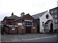
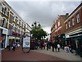
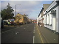
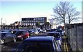
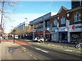
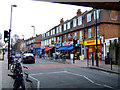
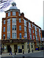


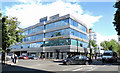
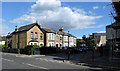
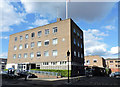
100 photos from this area
Area Information
Key information about the TW3 2AH including its size, population, and administrative classification.
- Area Type
- Postcode
- Area Size
- 8103 m²
- Population
- 2053
- Population Density
- 10024 people/km²
House Prices in TW3 2AH
53
Properties
£311,316
Average Sold Price
£95,000
Lowest Price
£490,000
Highest Price
Showing 53 properties
| Address | Type | Beds | Baths | Last Sale Price | Last Sale Date | |
|---|---|---|---|---|---|---|
| 42 Station Road, Hounslow, TW3 2AH | Terraced | 3 | 1 | £422,000 | Oct 2025 | |
| 44 Station Road, Hounslow, TW3 2AH | Semi-detached | 4 | 5 | £490,000 | Oct 2025 | |
| 30 Station Road, Hounslow, TW3 2AH | Semi-detached | 2 | 1 | £411,000 | Sep 2024 | |
| 4 Station Road, Hounslow, TW3 2AH | Terraced | 2 | 1 | £375,000 | Aug 2024 | |
| 40 Station Road, Hounslow, TW3 2AH | Terraced | 4 | 2 | £450,000 | Jul 2024 | |
| 70 Station Road, Hounslow, TW3 2AH | Terraced | 2 | 1 | £400,000 | Apr 2024 | |
| 12 Station Road, Hounslow, TW3 2AH | Cottage | 2 | 1 | £382,500 | Feb 2024 | |
| 56 Station Road, Hounslow, TW3 2AH | Terraced | 3 | 2 | £414,000 | Jul 2022 | |
| 2 Station Road, Hounslow, TW3 2AH | Terraced | 4 | 2 | £395,000 | Mar 2021 | |
| 66 Station Road, Hounslow, TW3 2AH | Terraced | 2 | 1 | £385,000 | Oct 2020 |
Page 1 of 6
Energy Efficiency in TW3 2AH
Amenities
Schools
| Rank | School | Type | Entry gender | Ages |
|---|
Explore more schools in this area
Go to Schools tabDemographics
Household Size
Family (3-5 people)
most common
Accommodation Type
Flats
most common
Tenure
34
majority
Ethnic Group
asian_total
most common
Religion
N/A
most common
Household Composition
N/A
most common
Age
47
median
Adults (30-64 years)
most common
Household Deprivation
N/A
with no deprivation
NS-SEC
26
in Lower managerial occupations
Explore more demographic insights in this area
Go to Demographics tabPlanning
Planning Constraints
- Flood RiskPremium
- Ramsar Wetland SitesPremium
- Area of Outstanding Natural BeautyPremium
- Protected Nature ReservePremium
- Protected WoodlandPremium