Area Overview for TW2 7AR
Photos of TW2 7AR

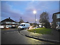
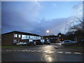
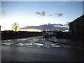
34 photos from this area
Area Information
Key information about the TW2 7AR including its size, population, and administrative classification.
- Area Type
- Postcode
- Area Size
- 4549 m²
- Population
- 1281
- Population Density
- 3504 people/km²
House Prices in TW2 7AR
21
Properties
£256,273
Average Sold Price
£80,000
Lowest Price
£537,000
Highest Price
Showing 21 properties
| Address | Type | Beds | Baths | Last Sale Price | Last Sale Date | |
|---|---|---|---|---|---|---|
| 67 Nelson Road, Twickenham, TW2 7AR | Terraced | 3 | 1 | £537,000 | Aug 2024 | |
| 63 Nelson Road, Twickenham, TW2 7AR | Terraced | 3 | 1 | £415,000 | Nov 2018 | |
| 79 Nelson Road, Twickenham, TW2 7AR | Terraced | 3 | - | £430,000 | Dec 2015 | |
| 13 Nelson Road, Twickenham, TW2 7AR | Flat | - | - | £94,000 | Aug 2013 | |
| 75 Nelson Road, Twickenham, TW2 7AR | house | 3 | - | £270,000 | Aug 2010 | |
| 69 Nelson Road, Twickenham, TW2 7AR | house | 3 | 1 | £282,000 | Jun 2010 | |
| 71 Nelson Road, Twickenham, TW2 7AR | Block of Flats | 3 | 2 | £225,000 | Nov 2006 | |
| 57 Nelson Road, Twickenham, TW2 7AR | Terraced | - | - | £220,000 | Dec 2003 | |
| 61 Nelson Road, Twickenham, TW2 7AR | Terraced | - | - | £158,000 | Aug 2001 | |
| 77 Nelson Road, Twickenham, TW2 7AR | Terraced | - | - | £108,000 | Aug 1999 |
Page 1 of 3
Energy Efficiency in TW2 7AR
Amenities
Schools
| Rank | School | Type | Entry gender | Ages |
|---|
Explore more schools in this area
Go to Schools tabDemographics
Household Size
Family (3-5 people)
most common
Accommodation Type
Houses
most common
Tenure
70
majority
Ethnic Group
White
most common
Religion
N/A
most common
Household Composition
N/A
most common
Age
47
median
Adults (30-64 years)
most common
Household Deprivation
N/A
with no deprivation
NS-SEC
46
in Lower managerial occupations
Explore more demographic insights in this area
Go to Demographics tabPlanning
Planning Constraints
- Flood RiskPremium
- Ramsar Wetland SitesPremium
- Area of Outstanding Natural BeautyPremium
- Protected Nature ReservePremium
- Protected WoodlandPremium