Area Overview for TW2 6QN
Photos of TW2 6QN

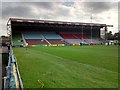

68 photos from this area
Area Information
Key information about the TW2 6QN including its size, population, and administrative classification.
- Area Type
- Postcode
- Area Size
- 1820 m²
- Population
- 2024
- Population Density
- 10564 people/km²
House Prices in TW2 6QN
11
Properties
£605,613
Average Sold Price
£290,000
Lowest Price
£1,040,400
Highest Price
Showing 11 properties
| Address | Type | Beds | Baths | Last Sale Price | Last Sale Date | |
|---|---|---|---|---|---|---|
| 106 Colne Road, Twickenham, TW2 6QN | Terraced | 3 | 1 | £1,040,400 | Jan 2025 | |
| 108 Colne Road, Twickenham, TW2 6QN | Terraced | 2 | 1 | £680,000 | Dec 2021 | |
| 114 Colne Road, Twickenham, TW2 6QN | house | 2 | 1 | £520,000 | Jun 2021 | |
| 116 Colne Road, Twickenham, TW2 6QN | Semi-detached | 4 | 1 | £855,000 | May 2017 | |
| 122 Colne Road, Twickenham, TW2 6QN | house | 3 | 1 | £675,000 | Sep 2016 | |
| 110 Colne Road, Twickenham, TW2 6QN | house | 2 | - | £412,000 | Feb 2011 | |
| 120 Colne Road, Twickenham, TW2 6QN | Terraced | - | - | £290,000 | Jul 2008 | |
| 104 Colne Road, Twickenham, TW2 6QN | Terraced | 5 | 2 | £372,500 | Jul 2002 | |
| First Floor Flat, 102 Colne Road, Twickenham, TW2 6QN | Flat | 2 | 1 | - | - | |
| 112 Colne Road, Twickenham, TW2 6QN | Cottage | 2 | 1 | - | - |
Page 1 of 2
Energy Efficiency in TW2 6QN
Amenities
Schools
| Rank | School | Type | Entry gender | Ages |
|---|
Explore more schools in this area
Go to Schools tabDemographics
Household Size
Family (3-5 people)
most common
Accommodation Type
Houses
most common
Tenure
69
majority
Ethnic Group
White
most common
Religion
N/A
most common
Household Composition
N/A
most common
Age
47
median
Adults (30-64 years)
most common
Household Deprivation
N/A
with no deprivation
NS-SEC
64
in Lower managerial occupations
Explore more demographic insights in this area
Go to Demographics tabPlanning
Planning Constraints
- Flood RiskPremium
- Ramsar Wetland SitesPremium
- Area of Outstanding Natural BeautyPremium
- Protected Nature ReservePremium
- Protected WoodlandPremium