Area Overview for TW16 7RS
Photos of TW16 7RS
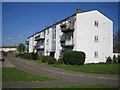
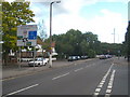
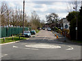
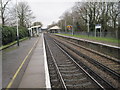
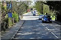


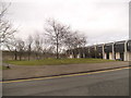
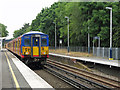
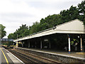
79 photos from this area
Area Information
Key information about the TW16 7RS including its size, population, and administrative classification.
- Area Type
- Postcode
- Area Size
- 16.9 hectares
- Population
- 1762
- Population Density
- 1164 people/km²
House Prices in TW16 7RS
49
Properties
£323,526
Average Sold Price
£61,500
Lowest Price
£520,000
Highest Price
Showing 49 properties
| Address | Type | Beds | Baths | Last Sale Price | Last Sale Date | |
|---|---|---|---|---|---|---|
| 206 Ashridge Way, Sunbury On Thames, TW16 7RS | Terraced | 3 | 1 | £445,000 | Feb 2024 | |
| 228 Ashridge Way, Sunbury On Thames, TW16 7RS | Flat | 4 | 2 | £380,000 | Jan 2024 | |
| 202 Ashridge Way, Sunbury On Thames, TW16 7RS | Terraced | 3 | 1 | £425,000 | Dec 2023 | |
| 176 Ashridge Way, Sunbury On Thames, TW16 7RS | Terraced | 3 | 2 | £510,000 | Oct 2023 | |
| 170 Ashridge Way, Sunbury On Thames, TW16 7RS | Terraced | 3 | 2 | £500,000 | Aug 2023 | |
| 182 Ashridge Way, Sunbury On Thames, TW16 7RS | house | - | - | £428,000 | Dec 2022 | |
| 178 Ashridge Way, Sunbury On Thames, TW16 7RS | Retail | 3 | 2 | £520,000 | May 2022 | |
| 224 Ashridge Way, Sunbury On Thames, TW16 7RS | house | - | - | £400,000 | Sep 2021 | |
| 158 Ashridge Way, Sunbury On Thames, TW16 7RS | Terraced | 3 | 1 | £390,000 | Sep 2021 | |
| 238 Ashridge Way, Sunbury On Thames, TW16 7RS | house | - | - | £396,000 | Mar 2021 |
Page 1 of 5
Energy Efficiency in TW16 7RS
Amenities
Schools
| Rank | School | Type | Entry gender | Ages |
|---|
Explore more schools in this area
Go to Schools tabDemographics
Household Size
Family (3-5 people)
most common
Accommodation Type
Houses
most common
Tenure
47
majority
Ethnic Group
White
most common
Religion
N/A
most common
Household Composition
N/A
most common
Age
47
median
Adults (30-64 years)
most common
Household Deprivation
N/A
with no deprivation
NS-SEC
24
in Lower managerial occupations
Explore more demographic insights in this area
Go to Demographics tabPlanning
Planning Constraints
- Flood RiskPremium
- Ramsar Wetland SitesPremium
- Area of Outstanding Natural BeautyPremium
- Protected Nature ReservePremium
- Protected WoodlandPremium