Area Overview for TW14 8HN
Photos of TW14 8HN
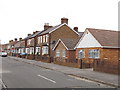
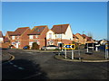
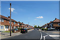
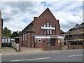
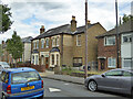

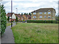

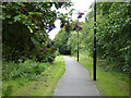
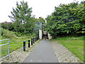
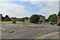
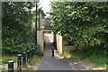
28 photos from this area
Area Information
Key information about the TW14 8HN including its size, population, and administrative classification.
- Area Type
- Postcode
- Area Size
- 7550 m²
- Population
- 2198
- Population Density
- 9349 people/km²
House Prices in TW14 8HN
34
Properties
£253,423
Average Sold Price
£104,000
Lowest Price
£495,000
Highest Price
Showing 34 properties
| Address | Type | Beds | Baths | Last Sale Price | Last Sale Date | |
|---|---|---|---|---|---|---|
| 20 New Road, Bedfont, TW14 8HN | house | 3 | 1 | £487,000 | Nov 2022 | |
| 30 New Road, Bedfont, TW14 8HN | Retail | 3 | 1 | £495,000 | May 2022 | |
| 4 New Road, Bedfont, TW14 8HN | house | 1 | - | £471,158 | Mar 2021 | |
| 36 New Road, Bedfont, TW14 8HN | Semi-detached | 3 | 1 | £367,500 | Feb 2019 | |
| 50 New Road, Bedfont, TW14 8HN | Terraced | 3 | 1 | £370,000 | Jun 2018 | |
| 46 New Road, Bedfont, TW14 8HN | house | - | - | £267,000 | Jan 2014 | |
| 42 New Road, Bedfont, TW14 8HN | Terraced | 3 | 1 | £248,000 | Feb 2013 | |
| 48 New Road, Bedfont, TW14 8HN | Terraced | - | - | £220,500 | May 2010 | |
| 2 New Road, Bedfont, TW14 8HN | Semi-detached | 1 | - | £245,000 | Feb 2008 | |
| 54 New Road, Bedfont, TW14 8HN | Terraced | 3 | 2 | £189,000 | Aug 2004 |
Page 1 of 4
Energy Efficiency in TW14 8HN
Amenities
Schools
| Rank | School | Type | Entry gender | Ages |
|---|
Explore more schools in this area
Go to Schools tabDemographics
Household Size
Family (3-5 people)
most common
Accommodation Type
Houses
most common
Tenure
42
majority
Ethnic Group
White
most common
Religion
N/A
most common
Household Composition
N/A
most common
Age
47
median
Adults (30-64 years)
most common
Household Deprivation
N/A
with no deprivation
NS-SEC
22
in Lower managerial occupations
Explore more demographic insights in this area
Go to Demographics tabPlanning
Planning Constraints
- Flood RiskPremium
- Ramsar Wetland SitesPremium
- Area of Outstanding Natural BeautyPremium
- Protected Nature ReservePremium
- Protected WoodlandPremium