Area Overview for TW14 8AD
Photos of TW14 8AD
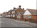
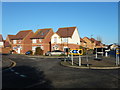
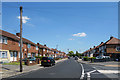
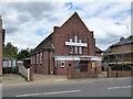
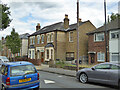
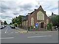
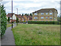
28 photos from this area
Area Information
Key information about the TW14 8AD including its size, population, and administrative classification.
- Area Type
- Postcode
- Area Size
- 1.2 hectares
- Population
- 2011
- Population Density
- 6032 people/km²
House Prices in TW14 8AD
39
Properties
£309,455
Average Sold Price
£82,000
Lowest Price
£556,000
Highest Price
Showing 39 properties
| Address | Type | Beds | Baths | Last Sale Price | Last Sale Date | |
|---|---|---|---|---|---|---|
| 28 Warfield Road, Feltham, TW14 8AD | Detached | 3 | 1 | £556,000 | Sep 2025 | |
| 29 Warfield Road, Feltham, TW14 8AD | Bungalow | 3 | 1 | £468,000 | Mar 2025 | |
| 33 Warfield Road, Feltham, TW14 8AD | Bungalow | 2 | 1 | £480,000 | Feb 2025 | |
| 31 Warfield Road, Feltham, TW14 8AD | Bungalow | 2 | 1 | £450,000 | Feb 2023 | |
| 35 Warfield Road, Feltham, TW14 8AD | Bungalow | - | - | £330,000 | Oct 2015 | |
| 8A Warfield Road, Feltham, TW14 8AD | Semi-detached | 3 | - | £248,000 | Mar 2013 | |
| 24 Warfield Road, Feltham, TW14 8AD | house | 3 | - | £250,000 | May 2012 | |
| 30 Warfield Road, Feltham, TW14 8AD | Semi-detached | - | - | £240,000 | Feb 2007 | |
| 23 Warfield Road, Feltham, TW14 8AD | Semi-detached | 3 | 1 | £180,000 | Nov 2003 | |
| 26 Warfield Road, Feltham, TW14 8AD | Semi-detached | 3 | - | £120,000 | Feb 2001 |
Page 1 of 4
Energy Efficiency in TW14 8AD
Amenities
Schools
| Rank | School | Type | Entry gender | Ages |
|---|
Explore more schools in this area
Go to Schools tabDemographics
Household Size
Family (3-5 people)
most common
Accommodation Type
Houses
most common
Tenure
56
majority
Ethnic Group
White
most common
Religion
N/A
most common
Household Composition
N/A
most common
Age
47
median
Adults (30-64 years)
most common
Household Deprivation
N/A
with no deprivation
NS-SEC
22
in Lower managerial occupations
Explore more demographic insights in this area
Go to Demographics tabPlanning
Planning Constraints
- Flood RiskPremium
- Ramsar Wetland SitesPremium
- Area of Outstanding Natural BeautyPremium
- Protected Nature ReservePremium
- Protected WoodlandPremium