Area Overview for TW14 0JW
Photos of TW14 0JW
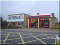
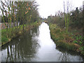
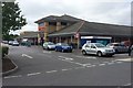
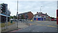
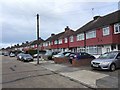
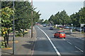
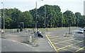
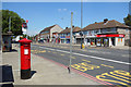
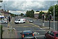
47 photos from this area
Area Information
Key information about the TW14 0JW including its size, population, and administrative classification.
- Area Type
- Postcode
- Area Size
- 8783 m²
- Population
- 2263
- Population Density
- 5091 people/km²
House Prices in TW14 0JW
28
Properties
£282,420
Average Sold Price
£115,000
Lowest Price
£484,000
Highest Price
Showing 28 properties
| Address | Type | Beds | Baths | Last Sale Price | Last Sale Date | |
|---|---|---|---|---|---|---|
| 65 Lansbury Avenue, Feltham, TW14 0JW | Terraced | 3 | 1 | £484,000 | May 2025 | |
| 95 Lansbury Avenue, Feltham, TW14 0JW | house | - | - | £475,000 | Jan 2025 | |
| 79 Lansbury Avenue, Feltham, TW14 0JW | Terraced | 3 | 1 | £468,000 | Sep 2023 | |
| 101 Lansbury Avenue, Feltham, TW14 0JW | Terraced | 1 | - | £365,000 | Feb 2021 | |
| 61 Lansbury Avenue, Feltham, TW14 0JW | Terraced | 3 | 1 | £395,000 | Sep 2019 | |
| 75 Lansbury Avenue, Feltham, TW14 0JW | house | - | - | £175,000 | Sep 2018 | |
| 107 Lansbury Avenue, Feltham, TW14 0JW | house | - | - | £402,000 | Jan 2017 | |
| 111 Lansbury Avenue, Feltham, TW14 0JW | Terraced | 3 | 1 | £400,000 | Nov 2016 | |
| 71 Lansbury Avenue, Feltham, TW14 0JW | Terraced | 4 | 1 | £370,000 | Jul 2016 | |
| 83 Lansbury Avenue, Feltham, TW14 0JW | house | - | - | £325,500 | Mar 2016 |
Page 1 of 3
Energy Efficiency in TW14 0JW
Amenities
Schools
| Rank | School | Type | Entry gender | Ages |
|---|
Explore more schools in this area
Go to Schools tabDemographics
Household Size
Family (3-5 people)
most common
Accommodation Type
Houses
most common
Tenure
60
majority
Ethnic Group
White
most common
Religion
N/A
most common
Household Composition
N/A
most common
Age
47
median
Adults (30-64 years)
most common
Household Deprivation
N/A
with no deprivation
NS-SEC
23
in Lower managerial occupations
Explore more demographic insights in this area
Go to Demographics tabPlanning
Planning Constraints
- Flood RiskPremium
- Ramsar Wetland SitesPremium
- Area of Outstanding Natural BeautyPremium
- Protected Nature ReservePremium
- Protected WoodlandPremium