Area Overview for TW14 0EA
Photos of TW14 0EA
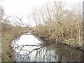
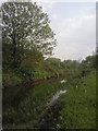
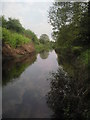
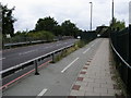


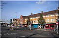

32 photos from this area
Area Information
Key information about the TW14 0EA including its size, population, and administrative classification.
- Area Type
- Postcode
- Area Size
- 1.5 hectares
- Population
- 1906
- Population Density
- 5854 people/km²
House Prices in TW14 0EA
46
Properties
£262,146
Average Sold Price
£37,100
Lowest Price
£465,000
Highest Price
Showing 46 properties
| Address | Type | Beds | Baths | Last Sale Price | Last Sale Date | |
|---|---|---|---|---|---|---|
| 37 Sparrow Farm Drive, Feltham, TW14 0EA | house | 2 | 1 | £380,000 | Feb 2025 | |
| 24 Sparrow Farm Drive, Feltham, TW14 0EA | Semi-detached | 3 | 1 | £422,000 | Mar 2024 | |
| 11 Sparrow Farm Drive, Feltham, TW14 0EA | Terraced | 2 | 1 | £390,000 | Feb 2024 | |
| 12 SPARROW FARM DRIVE, Feltham, TW14 0EA | Detached | 3 | - | £435,000 | Jul 2022 | |
| 29 Sparrow Farm Drive, Feltham, TW14 0EA | Retail | 3 | 1 | £405,000 | Feb 2022 | |
| 31 Sparrow Farm Drive, Feltham, TW14 0EA | house | - | - | £465,000 | Nov 2021 | |
| 35 Sparrow Farm Drive, Feltham, TW14 0EA | Terraced | 3 | 1 | £345,000 | Jul 2018 | |
| 8 Sparrow Farm Drive, Feltham, TW14 0EA | Semi-detached | 3 | - | £267,000 | Nov 2015 | |
| 15 Sparrow Farm Drive, Feltham, TW14 0EA | Terraced | 3 | 1 | £280,000 | Feb 2015 | |
| 16 Sparrow Farm Drive, Feltham, TW14 0EA | Terraced | 4 | 1 | £301,111 | Dec 2014 |
Page 1 of 5
Energy Efficiency in TW14 0EA
Amenities
Schools
| Rank | School | Type | Entry gender | Ages |
|---|
Explore more schools in this area
Go to Schools tabDemographics
Household Size
Family (3-5 people)
most common
Accommodation Type
Houses
most common
Tenure
62
majority
Ethnic Group
White
most common
Religion
N/A
most common
Household Composition
N/A
most common
Age
47
median
Adults (30-64 years)
most common
Household Deprivation
N/A
with no deprivation
NS-SEC
23
in Lower managerial occupations
Explore more demographic insights in this area
Go to Demographics tabPlanning
Planning Constraints
- Flood RiskPremium
- Ramsar Wetland SitesPremium
- Area of Outstanding Natural BeautyPremium
- Protected Nature ReservePremium
- Protected WoodlandPremium