Area Overview for TW13 7JT
Photos of TW13 7JT


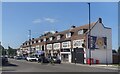
45 photos from this area
Area Information
Key information about the TW13 7JT including its size, population, and administrative classification.
- Area Type
- Postcode
- Area Size
- 3630 m²
- Population
- 1624
- Population Density
- 7142 people/km²
House Prices in TW13 7JT
17
Properties
£375,200
Average Sold Price
£203,000
Lowest Price
£562,000
Highest Price
Showing 17 properties
| Address | Type | Beds | Baths | Last Sale Price | Last Sale Date | |
|---|---|---|---|---|---|---|
| 11 Sherringham Avenue, Feltham, TW13 7JT | Semi-detached | 3 | 1 | £540,000 | Mar 2025 | |
| 6 Sherringham Avenue, Feltham, TW13 7JT | Semi-detached | 4 | 2 | £562,000 | Aug 2022 | |
| 4 Sherringham Avenue, Feltham, TW13 7JT | Semi-detached | 3 | 2 | £445,000 | Jul 2020 | |
| 2 Sherringham Avenue, Feltham, TW13 7JT | house | - | - | £390,000 | Mar 2018 | |
| 1 Sherringham Avenue, Feltham, TW13 7JT | house | 3 | 1 | £420,000 | Oct 2016 | |
| 5 Sherringham Avenue, Feltham, TW13 7JT | house | - | - | £385,000 | Feb 2016 | |
| 7 Sherringham Avenue, Feltham, TW13 7JT | house | - | - | £355,000 | Jun 2015 | |
| 13 Sherringham Avenue, Feltham, TW13 7JT | Semi-detached | 3 | - | £248,000 | Nov 2013 | |
| 3 Sherringham Avenue, Feltham, TW13 7JT | house | - | - | £204,000 | Sep 2006 | |
| 9 Sherringham Avenue, Feltham, TW13 7JT | house | - | - | £203,000 | Oct 2004 |
Page 1 of 2
Energy Efficiency in TW13 7JT
Amenities
Schools
| Rank | School | Type | Entry gender | Ages |
|---|
Explore more schools in this area
Go to Schools tabDemographics
Household Size
Family (3-5 people)
most common
Accommodation Type
Houses
most common
Tenure
67
majority
Ethnic Group
White
most common
Religion
N/A
most common
Household Composition
N/A
most common
Age
47
median
Adults (30-64 years)
most common
Household Deprivation
N/A
with no deprivation
NS-SEC
25
in Lower managerial occupations
Explore more demographic insights in this area
Go to Demographics tabPlanning
Planning Constraints
- Flood RiskPremium
- Ramsar Wetland SitesPremium
- Area of Outstanding Natural BeautyPremium
- Protected Nature ReservePremium
- Protected WoodlandPremium