Area Overview for TW13 4TB
Photos of TW13 4TB
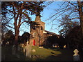
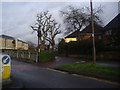
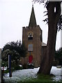
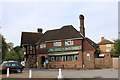
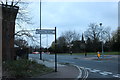
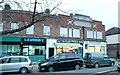
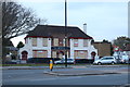
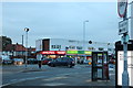
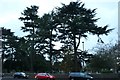
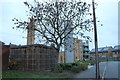
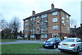
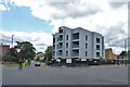
41 photos from this area
Area Information
Key information about the TW13 4TB including its size, population, and administrative classification.
- Area Type
- Postcode
- Area Size
- 1.8 hectares
- Population
- 2143
- Population Density
- 4645 people/km²
House Prices in TW13 4TB
46
Properties
£137,579
Average Sold Price
£38,495
Lowest Price
£235,000
Highest Price
Showing 46 properties
| Address | Type | Beds | Baths | Last Sale Price | Last Sale Date | |
|---|---|---|---|---|---|---|
| 38 Redford Close, Feltham, TW13 4TB | Flat | 1 | 1 | £189,000 | Jun 2025 | |
| 39 Redford Close, Feltham, TW13 4TB | Flat | 1 | 1 | £187,000 | Jan 2024 | |
| 34 Redford Close, Feltham, TW13 4TB | Flat | - | - | £168,000 | Mar 2023 | |
| 50 Redford Close, Feltham, TW13 4TB | Flat | 2 | - | £190,000 | Feb 2022 | |
| 52 Redford Close, Feltham, TW13 4TB | Flat | - | - | £195,000 | Apr 2019 | |
| 70 Redford Close, Feltham, TW13 4TB | Flat | - | - | £230,000 | Dec 2018 | |
| 56 Redford Close, Feltham, TW13 4TB | Flat | - | - | £195,000 | Mar 2018 | |
| 54 Redford Close, Feltham, TW13 4TB | Flat | - | - | £214,000 | Oct 2017 | |
| 60 Redford Close, Feltham, TW13 4TB | Flat | - | - | £219,500 | Sep 2017 | |
| 64 Redford Close, Feltham, TW13 4TB | Flat | - | - | £235,000 | Dec 2016 |
Page 1 of 5
Energy Efficiency in TW13 4TB
Amenities
Schools
| Rank | School | Type | Entry gender | Ages |
|---|
Explore more schools in this area
Go to Schools tabDemographics
Household Size
Family (3-5 people)
most common
Accommodation Type
Flats
most common
Tenure
45
majority
Ethnic Group
White
most common
Religion
N/A
most common
Household Composition
N/A
most common
Age
47
median
Adults (30-64 years)
most common
Household Deprivation
N/A
with no deprivation
NS-SEC
23
in Lower managerial occupations
Explore more demographic insights in this area
Go to Demographics tabPlanning
Planning Constraints
- Flood RiskPremium
- Ramsar Wetland SitesPremium
- Area of Outstanding Natural BeautyPremium
- Protected Nature ReservePremium
- Protected WoodlandPremium