Area Overview for TW13 4RT
Photos of TW13 4RT
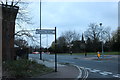
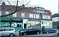
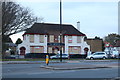
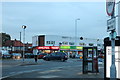
41 photos from this area
Area Information
Key information about the TW13 4RT including its size, population, and administrative classification.
- Area Type
- Postcode
- Area Size
- 1.3 hectares
- Population
- 1875
- Population Density
- 1197 people/km²
House Prices in TW13 4RT
23
Properties
£278,346
Average Sold Price
£199,000
Lowest Price
£434,000
Highest Price
Showing 23 properties
| Address | Type | Beds | Baths | Last Sale Price | Last Sale Date | |
|---|---|---|---|---|---|---|
| 71 Elvedon Road, Feltham, TW13 4RT | Detached | 3 | 1 | £434,000 | Jun 2023 | |
| 78 Elvedon Road, Feltham, TW13 4RT | Terraced | 3 | - | £365,000 | Dec 2017 | |
| 91 Elvedon Road, Feltham, TW13 4RT | Semi-detached | 3 | 1 | £425,000 | Oct 2017 | |
| 68 Elvedon Road, Feltham, TW13 4RT | Terraced | 2 | 2 | £325,000 | Oct 2016 | |
| 72 Elvedon Road, Feltham, TW13 4RT | house | - | - | £330,000 | Jul 2016 | |
| 77 Elvedon Road, Feltham, TW13 4RT | Terraced | 2 | 1 | £310,000 | Mar 2016 | |
| 113 Elvedon Road, Feltham, TW13 4RT | Terraced | 3 | 1 | £296,000 | Feb 2016 | |
| 94 Elvedon Road, Feltham, TW13 4RT | Terraced | 3 | 2 | £295,000 | Dec 2014 | |
| 73 Elvedon Road, Feltham, TW13 4RT | Terraced | 2 | 2 | £249,950 | Jul 2014 | |
| 112 Elvedon Road, Feltham, TW13 4RT | Terraced | 2 | 1 | £215,000 | Jun 2014 |
Page 1 of 3
Energy Efficiency in TW13 4RT
Amenities
Schools
| Rank | School | Type | Entry gender | Ages |
|---|
Explore more schools in this area
Go to Schools tabDemographics
Household Size
Family (3-5 people)
most common
Accommodation Type
Houses
most common
Tenure
60
majority
Ethnic Group
White
most common
Religion
N/A
most common
Household Composition
N/A
most common
Age
47
median
Adults (30-64 years)
most common
Household Deprivation
N/A
with no deprivation
NS-SEC
30
in Lower managerial occupations
Explore more demographic insights in this area
Go to Demographics tabPlanning
Planning Constraints
- Flood RiskPremium
- Ramsar Wetland SitesPremium
- Area of Outstanding Natural BeautyPremium
- Protected Nature ReservePremium
- Protected WoodlandPremium