Area Overview for TW13 4HR
Photos of TW13 4HR
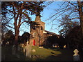
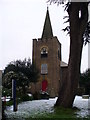
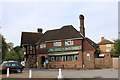
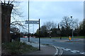
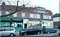
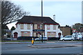

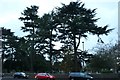
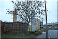
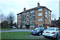
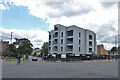
41 photos from this area
Area Information
Key information about the TW13 4HR including its size, population, and administrative classification.
- Area Type
- Postcode
- Area Size
- 4250 m²
- Population
- 1927
- Population Density
- 8584 people/km²
House Prices in TW13 4HR
12
Properties
£151,600
Average Sold Price
£47,500
Lowest Price
£285,000
Highest Price
Showing 12 properties
| Address | Type | Beds | Baths | Last Sale Price | Last Sale Date | |
|---|---|---|---|---|---|---|
| 7, The Hermitage, St Dunstans Road, Feltham, TW13 4HR | Flat | - | - | £265,000 | Jul 2019 | |
| 1, The Hermitage, St Dunstans Road, Feltham, TW13 4HR | Flat | 3 | 2 | £285,000 | Feb 2019 | |
| 8, The Hermitage, St Dunstans Road, Feltham, TW13 4HR | Flat | - | - | £255,000 | Feb 2017 | |
| 2, The Hermitage, St Dunstans Road, Feltham, TW13 4HR | Flat | - | - | £200,000 | Aug 2015 | |
| 10, The Hermitage, St Dunstans Road, Feltham, TW13 4HR | Flat | - | - | £133,000 | Nov 2006 | |
| 5, The Hermitage, St Dunstans Road, Feltham, TW13 4HR | Flat | - | - | £103,000 | Feb 2003 | |
| 12, The Hermitage, St Dunstans Road, Feltham, TW13 4HR | Flat | - | - | £80,500 | Sep 2000 | |
| 9, The Hermitage, St Dunstans Road, Feltham, TW13 4HR | Flat | - | - | £82,000 | May 2000 | |
| 11, The Hermitage, St Dunstans Road, Feltham, TW13 4HR | Flat | - | - | £65,000 | Feb 2000 | |
| 3, The Hermitage, St Dunstans Road, Feltham, TW13 4HR | Flat | - | - | £47,500 | Apr 1995 |
Page 1 of 2
Energy Efficiency in TW13 4HR
Amenities
Schools
| Rank | School | Type | Entry gender | Ages |
|---|
Explore more schools in this area
Go to Schools tabDemographics
Household Size
Family (3-5 people)
most common
Accommodation Type
Houses
most common
Tenure
51
majority
Ethnic Group
White
most common
Religion
N/A
most common
Household Composition
N/A
most common
Age
47
median
Adults (30-64 years)
most common
Household Deprivation
N/A
with no deprivation
NS-SEC
24
in Lower managerial occupations
Explore more demographic insights in this area
Go to Demographics tabPlanning
Planning Constraints
- Flood RiskPremium
- Ramsar Wetland SitesPremium
- Area of Outstanding Natural BeautyPremium
- Protected Nature ReservePremium
- Protected WoodlandPremium