Area Overview for TW12 3AX
Photos of TW12 3AX

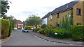

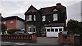

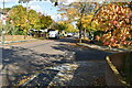

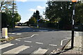
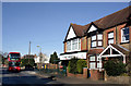
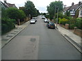

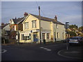
41 photos from this area
Area Information
Key information about the TW12 3AX including its size, population, and administrative classification.
- Area Type
- Postcode
- Area Size
- 1.2 hectares
- Population
- 1630
- Population Density
- 5003 people/km²
House Prices in TW12 3AX
14
Properties
£746,667
Average Sold Price
£230,000
Lowest Price
£1,350,000
Highest Price
Showing 14 properties
| Address | Type | Beds | Baths | Last Sale Price | Last Sale Date | |
|---|---|---|---|---|---|---|
| 73 Broad Lane, Hampton, TW12 3AX | Detached | 4 | 2 | £1,125,000 | Nov 2023 | |
| 69 Broad Lane, Hampton, TW12 3AX | Maisonette | 3 | 1 | £495,000 | Jan 2019 | |
| 61 Broad Lane, Hampton, TW12 3AX | Semi-detached | 5 | - | £1,350,000 | Jul 2018 | |
| 57 Broad Lane, Hampton, TW12 3AX | Detached | 6 | 2 | £1,200,000 | Oct 2014 | |
| 53 Broad Lane, Hampton, TW12 3AX | Semi-detached | 5 | 3 | £545,000 | Jan 2010 | |
| 75 Broad Lane, Hampton, TW12 3AX | Detached | 4 | 2 | £600,000 | Dec 2006 | |
| 59 Broad Lane, Hampton, TW12 3AX | house | - | - | £940,000 | May 2006 | |
| 49 Broad Lane, Hampton, TW12 3AX | Detached | 4 | - | £235,000 | Mar 1998 | |
| 55 Broad Lane, Hampton, TW12 3AX | Detached | - | - | £230,000 | Nov 1996 | |
| 75B Broad Lane, Hampton, TW12 3AX | Detached | 4 | 2 | - | - |
Page 1 of 2
Energy Efficiency in TW12 3AX
Amenities
Schools
| Rank | School | Type | Entry gender | Ages |
|---|
Explore more schools in this area
Go to Schools tabDemographics
Household Size
Family (3-5 people)
most common
Accommodation Type
Houses
most common
Tenure
81
majority
Ethnic Group
White
most common
Religion
N/A
most common
Household Composition
N/A
most common
Age
47
median
Adults (30-64 years)
most common
Household Deprivation
N/A
with no deprivation
NS-SEC
59
in Lower managerial occupations
Explore more demographic insights in this area
Go to Demographics tabPlanning
Planning Constraints
- Flood RiskPremium
- Ramsar Wetland SitesPremium
- Area of Outstanding Natural BeautyPremium
- Protected Nature ReservePremium
- Protected WoodlandPremium