Area Overview for TW12 2LT
Photos of TW12 2LT
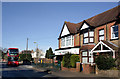
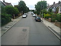
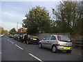
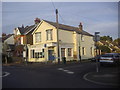
41 photos from this area
Area Information
Key information about the TW12 2LT including its size, population, and administrative classification.
- Area Type
- Postcode
- Area Size
- 7012 m²
- Population
- 1480
- Population Density
- 3946 people/km²
House Prices in TW12 2LT
10
Properties
£769,994
Average Sold Price
£299,950
Lowest Price
£1,780,000
Highest Price
Showing 10 properties
| Address | Type | Beds | Baths | Last Sale Price | Last Sale Date | |
|---|---|---|---|---|---|---|
| 46 Wensleydale Road, Hampton, TW12 2LT | Detached | 5 | 2 | £1,780,000 | Feb 2025 | |
| 40 Wensleydale Road, Hampton, TW12 2LT | house | 4 | 2 | £1,015,000 | Aug 2019 | |
| 36 Wensleydale Road, Hampton, TW12 2LT | house | - | - | £890,000 | Dec 2012 | |
| 50 Wensleydale Road, Hampton, TW12 2LT | Detached | 5 | 3 | £810,000 | Oct 2009 | |
| 52 Wensleydale Road, Hampton, TW12 2LT | Detached | 5 | 3 | £299,950 | Nov 2001 | |
| 38 Wensleydale Road, Hampton, TW12 2LT | Detached | - | - | £470,000 | Sep 2001 | |
| 44 Wensleydale Road, Hampton, TW12 2LT | Detached | - | - | £530,000 | Sep 2000 | |
| 42 Wensleydale Road, Hampton, TW12 2LT | house | - | - | £365,000 | Oct 1998 | |
| 34 Wensleydale Road, Hampton, TW12 2LT | Detached | 5 | - | - | - | |
| 48 Wensleydale Road, Hampton, TW12 2LT | Detached | - | - | - | - |
Energy Efficiency in TW12 2LT
Amenities
Schools
| Rank | School | Type | Entry gender | Ages |
|---|
Explore more schools in this area
Go to Schools tabDemographics
Household Size
Family (3-5 people)
most common
Accommodation Type
Houses
most common
Tenure
94
majority
Ethnic Group
White
most common
Religion
N/A
most common
Household Composition
N/A
most common
Age
47
median
Adults (30-64 years)
most common
Household Deprivation
N/A
with no deprivation
NS-SEC
59
in Lower managerial occupations
Explore more demographic insights in this area
Go to Demographics tabPlanning
Planning Constraints
- Flood RiskPremium
- Ramsar Wetland SitesPremium
- Area of Outstanding Natural BeautyPremium
- Protected Nature ReservePremium
- Protected WoodlandPremium