Area Overview for TW11 9DE
Photos of TW11 9DE
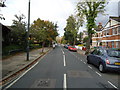
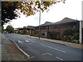
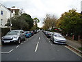
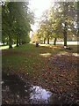
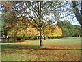
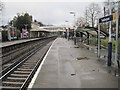
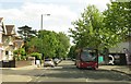
57 photos from this area
Area Information
Key information about the TW11 9DE including its size, population, and administrative classification.
- Area Type
- Postcode
- Area Size
- 1.0 hectares
- Population
- 1790
- Population Density
- 5898 people/km²
House Prices in TW11 9DE
24
Properties
£614,206
Average Sold Price
£144,000
Lowest Price
£1,500,000
Highest Price
Showing 24 properties
| Address | Type | Beds | Baths | Last Sale Price | Last Sale Date | |
|---|---|---|---|---|---|---|
| 21 St Marks Road, Teddington, TW11 9DE | Maisonette | - | - | £435,000 | Aug 2024 | |
| 43 St Marks Road, Teddington, TW11 9DE | Retail | 3 | 1 | £985,000 | Jan 2022 | |
| 11 St Marks Road, Teddington, TW11 9DE | Flat | - | - | £380,000 | Sep 2019 | |
| 33 St Marks Road, Teddington, TW11 9DE | Terraced | 4 | 2 | £970,000 | Oct 2017 | |
| 9 St Marks Road, Teddington, TW11 9DE | Semi-detached | 5 | 3 | £1,500,000 | Aug 2015 | |
| 7 St Marks Road, Teddington, TW11 9DE | Semi-detached | 5 | 3 | £1,500,000 | Aug 2015 | |
| 15 St Marks Road, Teddington, TW11 9DE | Maisonette | - | - | £250,000 | Feb 2012 | |
| 31 St Marks Road, Teddington, TW11 9DE | house | 4 | - | £760,000 | Nov 2011 | |
| 49 St Marks Road, Teddington, TW11 9DE | house | - | - | £640,000 | Jan 2011 | |
| 45 St Marks Road, Teddington, TW11 9DE | Detached | - | - | £575,000 | Nov 2006 |
Page 1 of 3
Energy Efficiency in TW11 9DE
Amenities
Schools
| Rank | School | Type | Entry gender | Ages |
|---|
Explore more schools in this area
Go to Schools tabDemographics
Household Size
Family (3-5 people)
most common
Accommodation Type
Houses
most common
Tenure
64
majority
Ethnic Group
White
most common
Religion
N/A
most common
Household Composition
N/A
most common
Age
47
median
Adults (30-64 years)
most common
Household Deprivation
N/A
with no deprivation
NS-SEC
57
in Lower managerial occupations
Explore more demographic insights in this area
Go to Demographics tabPlanning
Planning Constraints
- Flood RiskPremium
- Ramsar Wetland SitesPremium
- Area of Outstanding Natural BeautyPremium
- Protected Nature ReservePremium
- Protected WoodlandPremium