Area Overview for TW11 8NB
Photos of TW11 8NB
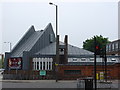
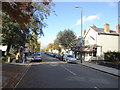


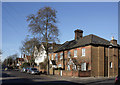

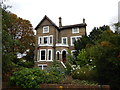
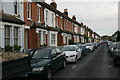
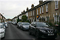
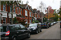
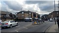
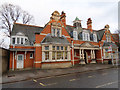
72 photos from this area
Area Information
Key information about the TW11 8NB including its size, population, and administrative classification.
- Area Type
- Postcode
- Area Size
- 9760 m²
- Population
- 1670
- Population Density
- 7742 people/km²
House Prices in TW11 8NB
36
Properties
£671,903
Average Sold Price
£138,000
Lowest Price
£1,615,000
Highest Price
Showing 36 properties
| Address | Type | Beds | Baths | Last Sale Price | Last Sale Date | |
|---|---|---|---|---|---|---|
| 35 Teddington Park Road, Teddington, TW11 8NB | Semi-detached | 4 | 3 | £1,615,000 | Nov 2025 | |
| 43 Teddington Park Road, Teddington, TW11 8NB | Terraced | 4 | 2 | £1,065,000 | Jun 2021 | |
| 39 Teddington Park Road, Teddington, TW11 8NB | house | 4 | - | £1,290,000 | Nov 2020 | |
| 31 Teddington Park Road, Teddington, TW11 8NB | house | - | - | £859,950 | Feb 2018 | |
| 1 Teddington Park Road, Teddington, TW11 8NB | Terraced | 4 | 2 | £940,000 | Dec 2015 | |
| 19 Teddington Park Road, Teddington, TW11 8NB | Terraced | 4 | - | £999,950 | Jul 2015 | |
| 37 Teddington Park Road, Teddington, TW11 8NB | house | - | - | £1,212,500 | Feb 2015 | |
| 15 Teddington Park Road, Teddington, TW11 8NB | Terraced | 4 | 2 | £880,000 | Apr 2013 | |
| 17 Teddington Park Road, Teddington, TW11 8NB | house | 3 | - | £750,000 | Jan 2013 | |
| 13 Teddington Park Road, Teddington, TW11 8NB | Terraced | - | - | £810,000 | Feb 2008 |
Page 1 of 4
Energy Efficiency in TW11 8NB
Amenities
Schools
| Rank | School | Type | Entry gender | Ages |
|---|
Explore more schools in this area
Go to Schools tabDemographics
Household Size
Family (3-5 people)
most common
Accommodation Type
Houses
most common
Tenure
71
majority
Ethnic Group
White
most common
Religion
N/A
most common
Household Composition
N/A
most common
Age
47
median
Adults (30-64 years)
most common
Household Deprivation
N/A
with no deprivation
NS-SEC
58
in Lower managerial occupations
Explore more demographic insights in this area
Go to Demographics tabPlanning
Planning Constraints
- Flood RiskPremium
- Ramsar Wetland SitesPremium
- Area of Outstanding Natural BeautyPremium
- Protected Nature ReservePremium
- Protected WoodlandPremium