Area Overview for TW11 0PS
Photos of TW11 0PS
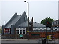
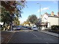

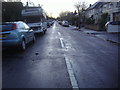
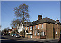

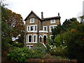
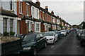
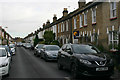
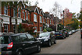
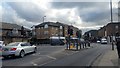
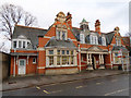
72 photos from this area
Area Information
Key information about the TW11 0PS including its size, population, and administrative classification.
- Area Type
- Postcode
- Area Size
- 6799 m²
- Population
- 1630
- Population Density
- 8611 people/km²
House Prices in TW11 0PS
26
Properties
£545,903
Average Sold Price
£153,000
Lowest Price
£969,950
Highest Price
Showing 26 properties
| Address | Type | Beds | Baths | Last Sale Price | Last Sale Date | |
|---|---|---|---|---|---|---|
| 9C Connaught Road, Teddington, TW11 0PS | Semi-detached | 3 | 1 | £702,000 | Nov 2022 | |
| 9 Connaught Road, Teddington, TW11 0PS | house | - | - | £825,550 | Nov 2020 | |
| 6 Connaught Road, Teddington, TW11 0PS | Terraced | 3 | 1 | £750,000 | Feb 2020 | |
| 12 Connaught Road, Teddington, TW11 0PS | house | - | - | £969,950 | Nov 2015 | |
| 2 Connaught Road, Teddington, TW11 0PS | Semi-detached | 3 | 1 | £782,000 | Sep 2015 | |
| 1 Connaught Road, Teddington, TW11 0PS | house | - | - | £580,000 | Feb 2013 | |
| 10 Connaught Road, Teddington, TW11 0PS | house | 4 | - | £615,000 | Dec 2010 | |
| 20 Connaught Road, Teddington, TW11 0PS | house | 4 | - | £661,000 | Jun 2010 | |
| 24 Connaught Road, Teddington, TW11 0PS | house | - | - | £590,000 | Aug 2009 | |
| 28 Connaught Road, Teddington, TW11 0PS | Terraced | - | - | £435,000 | Dec 2005 |
Page 1 of 3
Energy Efficiency in TW11 0PS
Amenities
Schools
| Rank | School | Type | Entry gender | Ages |
|---|
Explore more schools in this area
Go to Schools tabDemographics
Household Size
Family (3-5 people)
most common
Accommodation Type
Houses
most common
Tenure
76
majority
Ethnic Group
White
most common
Religion
N/A
most common
Household Composition
N/A
most common
Age
47
median
Adults (30-64 years)
most common
Household Deprivation
N/A
with no deprivation
NS-SEC
59
in Lower managerial occupations
Explore more demographic insights in this area
Go to Demographics tabPlanning
Planning Constraints
- Flood RiskPremium
- Ramsar Wetland SitesPremium
- Area of Outstanding Natural BeautyPremium
- Protected Nature ReservePremium
- Protected WoodlandPremium