Area Overview for TW1 1NA
Photos of TW1 1NA
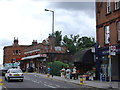
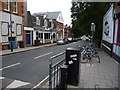
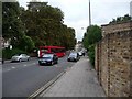
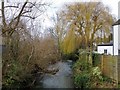
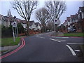

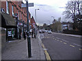
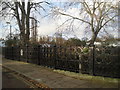
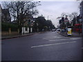

82 photos from this area
Area Information
Key information about the TW1 1NA including its size, population, and administrative classification.
- Area Type
- Postcode
- Area Size
- 3668 m²
- Population
- 1694
- Population Density
- 11007 people/km²
House Prices in TW1 1NA
14
Properties
£491,835
Average Sold Price
£205,000
Lowest Price
£1,050,000
Highest Price
Showing 14 properties
| Address | Type | Beds | Baths | Last Sale Price | Last Sale Date | |
|---|---|---|---|---|---|---|
| 2 Normanhurst Drive, Twickenham, TW1 1NA | Terraced | 4 | 2 | £1,050,000 | Jan 2023 | |
| 12 Normanhurst Drive, Twickenham, TW1 1NA | house | - | - | £860,000 | Mar 2018 | |
| 9 Normanhurst Drive, Twickenham, TW1 1NA | Terraced | 3 | 2 | £825,000 | Jan 2017 | |
| 5 Normanhurst Drive, Twickenham, TW1 1NA | house | - | - | £380,000 | Jun 2009 | |
| 4 Normanhurst Drive, Twickenham, TW1 1NA | house | - | - | £385,000 | Mar 2009 | |
| 13 Normanhurst Drive, Twickenham, TW1 1NA | Detached | 3 | 2 | £380,000 | Nov 2005 | |
| 11 Normanhurst Drive, Twickenham, TW1 1NA | Terraced | - | - | £359,950 | Aug 2004 | |
| 8 Normanhurst Drive, Twickenham, TW1 1NA | Terraced | - | - | £263,400 | Apr 2001 | |
| 14 Normanhurst Drive, Twickenham, TW1 1NA | Terraced | - | - | £210,000 | Jun 1999 | |
| 10 Normanhurst Drive, Twickenham, TW1 1NA | house | - | - | £205,000 | Apr 1999 |
Page 1 of 2
Energy Efficiency in TW1 1NA
Amenities
Schools
| Rank | School | Type | Entry gender | Ages |
|---|
Explore more schools in this area
Go to Schools tabDemographics
Household Size
Family (3-5 people)
most common
Accommodation Type
Houses
most common
Tenure
77
majority
Ethnic Group
White
most common
Religion
N/A
most common
Household Composition
N/A
most common
Age
47
median
Adults (30-64 years)
most common
Household Deprivation
N/A
with no deprivation
NS-SEC
68
in Lower managerial occupations
Explore more demographic insights in this area
Go to Demographics tabPlanning
Planning Constraints
- Flood RiskPremium
- Ramsar Wetland SitesPremium
- Area of Outstanding Natural BeautyPremium
- Protected Nature ReservePremium
- Protected WoodlandPremium