Area Overview for TW1 1JG
Photos of TW1 1JG
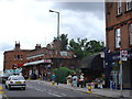
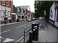
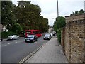
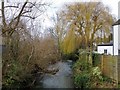


82 photos from this area
Area Information
Key information about the TW1 1JG including its size, population, and administrative classification.
- Area Type
- Postcode
- Area Size
- 9192 m²
- Population
- 1694
- Population Density
- 11007 people/km²
House Prices in TW1 1JG
52
Properties
£671,849
Average Sold Price
£108,500
Lowest Price
£1,290,000
Highest Price
Showing 52 properties
| Address | Type | Beds | Baths | Last Sale Price | Last Sale Date | |
|---|---|---|---|---|---|---|
| 18 St Margarets Grove, Twickenham, TW1 1JG | Terraced | 2 | 2 | £980,000 | Jul 2025 | |
| 82 St Margarets Grove, Twickenham, TW1 1JG | Terraced | 3 | 3 | £1,100,000 | Sep 2024 | |
| 8 St Margarets Grove, Twickenham, TW1 1JG | Terraced | 2 | 2 | £825,000 | May 2024 | |
| 98 St Margarets Grove, Twickenham, TW1 1JG | house | 2 | 1 | £692,450 | Oct 2023 | |
| 58 St Margarets Grove, Twickenham, TW1 1JG | Terraced | 3 | 2 | £1,055,000 | May 2023 | |
| 36 St Margarets Grove, Twickenham, TW1 1JG | Terraced | 4 | 4 | £970,000 | Jan 2023 | |
| 24 St Margarets Grove, Twickenham, TW1 1JG | Terraced | 2 | 1 | £710,000 | Jan 2023 | |
| 70 St Margarets Grove, Twickenham, TW1 1JG | Terraced | 4 | 2 | £1,185,000 | Jul 2022 | |
| 10 St Margarets Grove, Twickenham, TW1 1JG | Cottage | 3 | 2 | £772,500 | Dec 2021 | |
| 106 St Margarets Grove, Twickenham, TW1 1JG | house | - | - | £1,290,000 | Jun 2021 |
Page 1 of 6
Energy Efficiency in TW1 1JG
Amenities
Schools
| Rank | School | Type | Entry gender | Ages |
|---|
Explore more schools in this area
Go to Schools tabDemographics
Household Size
Family (3-5 people)
most common
Accommodation Type
Houses
most common
Tenure
77
majority
Ethnic Group
White
most common
Religion
N/A
most common
Household Composition
N/A
most common
Age
47
median
Adults (30-64 years)
most common
Household Deprivation
N/A
with no deprivation
NS-SEC
68
in Lower managerial occupations
Explore more demographic insights in this area
Go to Demographics tabPlanning
Planning Constraints
- Flood RiskPremium
- Ramsar Wetland SitesPremium
- Area of Outstanding Natural BeautyPremium
- Protected Nature ReservePremium
- Protected WoodlandPremium