Area Overview for Tower Hamlets
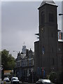
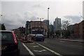
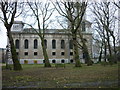
Photos of Tower Hamlets


Area Information
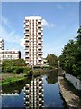
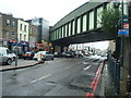
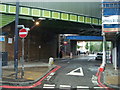
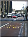
Tower Hamlets is a built-up area in east London covering 18.7 km², home to 218,018 residents. With a population density of 11,681 people per square kilometre, it is one of the most densely populated places in England. The area’s character is shaped by its proximity to London City Airport and its integration into the city’s transport network. Daily life here is defined by urban convenience, with a mix of residential, commercial, and industrial spaces. The median age of 70 suggests a community skewed towards older residents, though the area remains a hub for commuters and workers. Tower Hamlets is served by multiple rail and metro stations, including Limehouse and Canary Wharf, offering easy access to central London. Its compact size means amenities are within walking distance for many, though the high density can create a sense of busyness. The area’s distinctiveness lies in its blend of historic architecture and modern infrastructure, alongside a transport network that connects it to the wider capital. For those considering living here, the challenge is balancing urban vibrancy with the realities of high population density.
- Area Type
- District/Borough
- Area Size
- 18.7 km²
- Population
- 218018
- Population Density
- 11681 people/km²
Demographics
The population of Tower Hamlets has a median age of 70, indicating a community where older residents predominate. Home ownership is low, with only 25% of households owning their homes, suggesting a rental market dominates. This statistic reflects the area’s role as a place of temporary residence for workers and students, rather than long-term homeownership. The data does not specify household composition or accommodation types, but the high population density implies a mix of shared housing and smaller dwellings. The area’s demographic profile is further shaped by its proximity to London’s financial district, attracting a transient workforce. While the data does not provide details on ethnic or religious diversity, the high density and transport connectivity suggest a cosmopolitan mix. However, the lack of specific figures on deprivation means it is difficult to assess how this affects quality of life. The age profile, combined with the low home ownership rate, points to a community that may require tailored services for older residents and renters.
Household Size
Accommodation Type
Tenure
Ethnic Group
Religion
Household Composition
Age
Household Deprivation
NS-SEC
Explore more demographic insights in this area
Go to Demographics tabPlanning
Planning Constraints
- Crime RiskPremium