Area Overview for Totteridge & Woodside Ward
Photos of Totteridge & Woodside Ward


Area Information
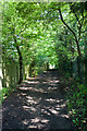
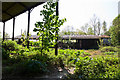
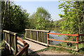
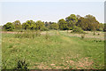
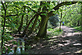
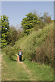
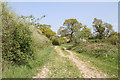
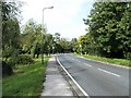
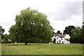
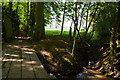
Totteridge & Woodside Ward stands apart from much of London due to its specific blend of suburban development and open green spaces. This electoral ward within the London Borough of Barnet covers 9.6 square kilometres and holds a resident population of 1,371 people. You will find yourself living in a zone that mixes the historical charm of the former village of Totteridge with the structured layout of the Woodside Park Garden Suburb. The area sits north of London near Dollis Brook and Folly Brook, offering a distinct rural quality that many urban developments lack. Living in Totteridge & Woodside Ward means enjoying a predominantly residential environment where large late-Victorian and Edwardian properties share space with 1930s garden suburb semis. The zone strictly adheres to its designation as a Conservation Area since 1968, ensuring no major developments have altered the skyline. Designated centres often lack comprehensive digital coverage, which remains a practical consideration for new arrivals. However, the retention of these historic features alongside open green valleys makes the area particularly appealing. Homes in Totteridge & Woodside Ward therefore offer a chance to live near Dollis Brook and Folly Brook while maintaining easy access to the city via the Northern line.
- Area Type
- District Borough Unitary Ward
- Area Size
- 9.6 km²
- Population
- 1371
- Population Density
- 143 people/km²
Demographics
The community profile of Totteridge & Woodside Ward reflects a mature, established neighbourhood. Analysis confirms a median age of 70 years, indicating a significant population of senior residents. The ward's total population of 1,371 people resides across a landscape characterised by substantial home ownership. Specifically, 68% of households own their homes outright, suggesting a stable, long-term community rather than a transient rental market. Accommodation data highlights that the majority of residents live in owner-occupied properties, reinforcing the area's character as a place for settled families and retirees. The ward does not provide specific breakdowns for predominant ethnic groups or religious affiliations within the available data, though the history notes Cardinal Manning was born locally in 1808. This historical context often hints at established community values. With such a high percentage of owner-occupiers, the social fabric is likely built on long-standing local ties rather than quick turnover. The population density of 143 people per square kilometre ensures a quiet environment without the intense congestion found elsewhere in the city.
Household Size
Accommodation Type
Tenure
Ethnic Group
Religion
Household Composition
Age
Household Deprivation
NS-SEC
Explore more demographic insights in this area
Go to Demographics tabPlanning
Planning Constraints
- Flood RiskPremium
- Ramsar Wetland SitesPremium
- Area of Outstanding Natural BeautyPremium
- Protected Nature ReservePremium
- Protected WoodlandPremium
- Crime RiskPremium