Area Overview for Thamesmead East Ward
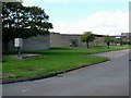
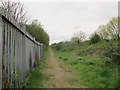
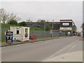
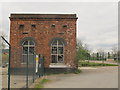
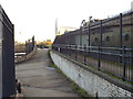
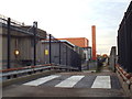
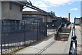
Photos of Thamesmead East Ward

Area Information
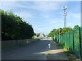
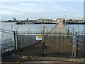
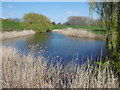
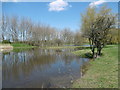
Thamesmead East Ward sits within the DA18 4AN postcode area as a unitary ward straddling the border between the Royal Borough of Greenwich and the London Borough of Bexley. You are looking at a planned residential development originating from the 1966 Greater London Council masterplan, designed to house 60,000 people across an area of 5.2 square kilometres. The geography features elevated housing built to mitigate flooding risks, alongside open spaces, man-made lakes, and canals that define the landscape. This post-war new town emerged in the late 1960s to address London's inner-city housing shortage, with the first residents moving in around 1967. One can walk near the River Thames at coordinates 51.49573, 0.151894 to appreciate the scale of the project. The construction phase began around 1967-1968, but the site was not new ground; a canal was constructed between 1812 and 1816 by convicts for the nearby Woolwich Royal Arsenal. The area subsequently gained cultural notability as a filming location for *A Clockwork Orange* in the early 1970s. Living here means navigating a large-scale urban experiment that has seen significant renewal efforts in recent years. The 1953 North Sea Flood influenced the original elevated design, ensuring homes sit above the channel levels. You are entering a community defined by mid-century modernist architecture and a history of ambitious, if sometimes troubled, public planning.
- Area Type
- District Borough Unitary Ward
- Area Size
- 5.2 km²
- Population
- 4670
- Population Density
- 905 people/km²
Demographics
The community profile in Thamesmead East Ward presents an older population demographic. The median age for residents reaches 70, which indicates a population heavily skewed towards seniors. When you look at household composition, the data reflects a community where many homes are occupied by older occupants. Home ownership stands at 34%, meaning the majority of the 4,670 residents identify as private tenants rather than owners. This low ownership rate suggests a market dominated by rental accommodation and social housing rather than owner-occupied properties. The ward accommodates a total population density of 905 people per square kilometre, which reflects the high-rise nature of the original development plan. Ethnic diversity and religious breakdowns are part of the total demographic picture, though specific figures for these groups are not detailed in the current dataset. Given the median age of 70, you will likely encounter fewer young families compared to other London wards. The accommodation type data is recorded as a total count, confirming the presence of substantial housing blocks. This demographic profile means local services and amenities cater significantly to the needs of an older, predominantly rented population.
Household Size
Accommodation Type
Tenure
Ethnic Group
Religion
Household Composition
Age
Household Deprivation
NS-SEC
Explore more demographic insights in this area
Go to Demographics tabPlanning
Planning Constraints
- Flood RiskPremium
- Ramsar Wetland SitesPremium
- Area of Outstanding Natural BeautyPremium
- Protected Nature ReservePremium
- Protected WoodlandPremium
- Crime RiskPremium