Area Overview for SW9 9UT
Photos of SW9 9UT
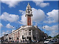

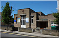
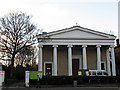
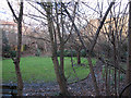
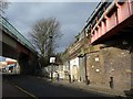
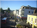
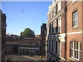
108 photos from this area
Area Information
Key information about the SW9 9UT including its size, population, and administrative classification.
- Area Type
- Postcode
- Area Size
- 1493 m²
- Population
- 1674
- Population Density
- 14444 people/km²
House Prices in SW9 9UT
12
Properties
£328,988
Average Sold Price
£184,950
Lowest Price
£495,000
Highest Price
Showing 12 properties
| Address | Type | Beds | Baths | Last Sale Price | Last Sale Date | |
|---|---|---|---|---|---|---|
| 107 Dalyell Road, London, SW9 9UT | Terraced | 5 | 2 | £495,000 | Mar 2007 | |
| 113 Dalyell Road, London, SW9 9UT | Terraced | 4 | 2 | £400,000 | Sep 2002 | |
| 105 Dalyell Road, London, SW9 9UT | house | 4 | - | £236,000 | Oct 2000 | |
| 115 Dalyell Road, London, SW9 9UT | Terraced | - | - | £184,950 | Jul 1999 | |
| 109 Dalyell Road, London, SW9 9UT | house | 3 | 2 | - | - | |
| Flat B, 101 Dalyell Road, London, SW9 9UT | Flat | 3 | 2 | - | - | |
| 4C, Dan Fodio Court, 111 Mayall Road, London, SW9 9UT | undefined | - | - | - | - | |
| Ground Floor Flat, 103 Dalyell Road, London, SW9 9UT | Flat | - | - | - | - | |
| 111 Dalyell Road, London, SW9 9UT | Terraced | - | - | - | - | |
| 99 Dalyell Road, London, SW9 9UT | house | - | - | - | - |
Page 1 of 2
Energy Efficiency in SW9 9UT
Amenities
Schools
| Rank | School | Type | Entry gender | Ages |
|---|
Explore more schools in this area
Go to Schools tabDemographics
Household Size
Two person
most common
Accommodation Type
Flats
most common
Tenure
38
majority
Ethnic Group
White
most common
Religion
N/A
most common
Household Composition
N/A
most common
Age
47
median
Adults (30-64 years)
most common
Household Deprivation
N/A
with no deprivation
NS-SEC
60
in Lower managerial occupations
Explore more demographic insights in this area
Go to Demographics tabPlanning
Planning Constraints
- Flood RiskPremium
- Ramsar Wetland SitesPremium
- Area of Outstanding Natural BeautyPremium
- Protected Nature ReservePremium
- Protected WoodlandPremium