Area Overview for SW9 9AN
Photos of SW9 9AN
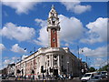

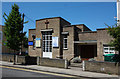
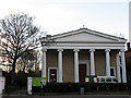
108 photos from this area
Area Information
Key information about the SW9 9AN including its size, population, and administrative classification.
- Area Type
- Postcode
- Area Size
- 2132 m²
- Population
- 2387
- Population Density
- 16905 people/km²
House Prices in SW9 9AN
22
Properties
£444,706
Average Sold Price
£235,000
Lowest Price
£972,500
Highest Price
Showing 22 properties
| Address | Type | Beds | Baths | Last Sale Price | Last Sale Date | |
|---|---|---|---|---|---|---|
| 1A Houghton Square, London, SW9 9AN | Flat | 1 | 1 | £390,000 | Mar 2025 | |
| 7 Houghton Square, London, SW9 9AN | Flat | 2 | 2 | £512,500 | Jul 2023 | |
| 20 Houghton Square, London, SW9 9AN | Flat | - | - | £640,000 | May 2017 | |
| 11 Houghton Square, London, SW9 9AN | Flat | 1 | 1 | £440,000 | Dec 2016 | |
| 21 Houghton Square, London, SW9 9AN | Terraced | 3 | 3 | £972,500 | Jun 2015 | |
| 9 Houghton Square, London, SW9 9AN | Flat | - | - | £399,950 | Jan 2015 | |
| 5 Houghton Square, London, SW9 9AN | Flat | - | - | £499,950 | May 2014 | |
| 12 Houghton Square, London, SW9 9AN | Flat | - | - | £410,000 | Oct 2011 | |
| 19 Houghton Square, London, SW9 9AN | Flat | - | - | £400,000 | May 2011 | |
| 16 Houghton Square, London, SW9 9AN | Flat | - | - | £472,500 | Mar 2008 |
Page 1 of 3
Energy Efficiency in SW9 9AN
Amenities
Schools
| Rank | School | Type | Entry gender | Ages |
|---|
Explore more schools in this area
Go to Schools tabDemographics
Household Size
Two person
most common
Accommodation Type
Flats
most common
Tenure
35
majority
Ethnic Group
White
most common
Religion
N/A
most common
Household Composition
N/A
most common
Age
47
median
Adults (30-64 years)
most common
Household Deprivation
N/A
with no deprivation
NS-SEC
60
in Lower managerial occupations
Explore more demographic insights in this area
Go to Demographics tabPlanning
Planning Constraints
- Flood RiskPremium
- Ramsar Wetland SitesPremium
- Area of Outstanding Natural BeautyPremium
- Protected Nature ReservePremium
- Protected WoodlandPremium