Area Overview for SW9 6NJ
Photos of SW9 6NJ
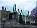


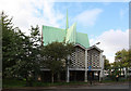
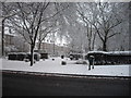
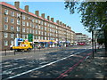


100 photos from this area
Area Information
Key information about the SW9 6NJ including its size, population, and administrative classification.
- Area Type
- Postcode
- Area Size
- 8188 m²
- Population
- 1604
- Population Density
- 10567 people/km²
House Prices in SW9 6NJ
66
Properties
£548,182
Average Sold Price
£185,000
Lowest Price
£850,000
Highest Price
Showing 66 properties
| Address | Type | Beds | Baths | Last Sale Price | Last Sale Date | |
|---|---|---|---|---|---|---|
| 143 Vassall Road, London, SW9 6NJ | Terraced | 4 | 1 | £800,000 | Dec 2024 | |
| 149 Vassall Road, London, SW9 6NJ | Terraced | 4 | 2 | £795,000 | Sep 2021 | |
| 129 Vassall Road, London, SW9 6NJ | Terraced | 3 | 1 | £725,000 | Feb 2020 | |
| 157 Vassall Road, London, SW9 6NJ | Terraced | 4 | 2 | £850,000 | Aug 2019 | |
| 121A Vassall Road, London, SW9 6NJ | Flat | - | - | £311,000 | Dec 2016 | |
| 135 Vassall Road, London, SW9 6NJ | Terraced | 4 | 1 | £810,000 | Nov 2016 | |
| 117D Vassall Road, London, SW9 6NJ | Flat | 1 | 1 | £500,000 | Nov 2014 | |
| 153 Vassall Road, London, SW9 6NJ | Terraced | 4 | - | £400,000 | Mar 2010 | |
| 139 Vassall Road, London, SW9 6NJ | house | 4 | - | £336,000 | Aug 2006 | |
| 131 Vassall Road, London, SW9 6NJ | Terraced | 4 | 2 | £318,000 | Oct 2005 |
Page 1 of 7
Energy Efficiency in SW9 6NJ
Amenities
Schools
| Rank | School | Type | Entry gender | Ages |
|---|
Explore more schools in this area
Go to Schools tabDemographics
Household Size
One person
most common
Accommodation Type
Flats
most common
Tenure
19
majority
Ethnic Group
black_total
most common
Religion
N/A
most common
Household Composition
N/A
most common
Age
47
median
Adults (30-64 years)
most common
Household Deprivation
N/A
with no deprivation
NS-SEC
32
in Lower managerial occupations
Explore more demographic insights in this area
Go to Demographics tabPlanning
Planning Constraints
- Flood RiskPremium
- Ramsar Wetland SitesPremium
- Area of Outstanding Natural BeautyPremium
- Protected Nature ReservePremium
- Protected WoodlandPremium